29 Sep - 6 Oct 2019
 |
| Bronze Bears at Lakeside Park, McCall |
Again we had WorldMark points to use or lose so C.J. booked us a week in central Idaho. The thought was that we could enjoy the fall colors and explore the area around McCall with our new e-bikes, paddle Payette Lake and maybe Cascade Lake, and hike to viewpoints in the surrounding mountains. It would have been perfect if the weather hadn't decided to take an unusual turn and produce "lumpy rain" and snow, as well as below-freezing temperatures. We still managed to have a good time and were glad that Ginny and Wally were able to join us for two nights on their way to an eagle-banding session in Montana.

29 Sep, Sun – Yesss! We got up to dry, almost sunny weather
so I pulled the wet tarp off the kayak (it had kept the cockpit covers dry) and
started packing. After getting stuff packed in the wayback, I put both bicycles on the
bike rack. We got started not too much later than our planned time of 0900 and
had dry roads. We were surprised to see the snow level down to the surface at
Snoqualmie Pass. Before we reached Ellensburg we started to run into showers. I
should have stopped at E-burg but I pushed on into harder rain and then snow as
we climbed Rye Grass Summit. I gave up and pulled into the rest area and
detached C.J.’s bike, folded it and put it into the back seat area. I was
actually glad that the rain had changed to snow so I didn't get too wet, but it was mighty cold out
of the car. I didn’t want to cover the tail lights and have the cover bag
flapping around so my bike remained unprotected (except where I had covered the
display with several layers of plastic bag. We got off I-90 just across the
Columbia and followed SR26 to Washtucna where we wound around through the
Palouse to our stop at Costco in Clarkston. We picked up some chips and a
rotisserie chicken and got gas (2.739) and motored on through Lewiston and up
US95 to White Bird and Riggins. It was later than we had expected when we
reached McCall (after a couple of construction delays) because we hadn’t taken
into consideration the change to Mountain Daylight Time. Still, it was light
when we checked in to WorldMark McCall shortly after 1900. We got a first floor
room so we didn’t have to carry our bikes – and everything else – up to the
second floor. After dinner we went back out to get some ice cream and some
stuff that was on sale at Albertson’s.
30 Sep, Mon – When we got up late this morning the sun was
shining but there was frost on the car and kayak; Google said the temperature
was 27 deg. After breakfast and a visit to the WM desk, C.J. decided that she
really needed to have some warmer gloves. The girl at Reception showed us where
 |
| Pioneer Cemetery near Secesh Meadow |
the thrift shops were so we headed into town. Toby’s Place was still closed at 1055
so we walked a bit farther to check out McPaws which had just what she
needed. We also found out that Ice Cream Alley was closed for the season and
that Toby’s had lots of stuff but no gloves. We also picked up a Titanium Sierra
Cup, which I mistook for cheap, lightweight aluminum, for 99 cents, and a
couple of other little things. Since we were in town, we went to the Ranger
Station (in an old CCC building) and got some information, maps and Smoky Bear
stuff. Since it was still early and the Warren Wagon Road along the west side
of Payette Lake was open during lunch break (12-1300), we decided to do the
scenic CD-narrated drive to Warren, about 44 miles. Rushing home, we threw in lunch
and warm clothes and even swim suits and towels in case we thought Burgdorf Hot
Springs looked inviting. We made it through the construction zone by 1245 and
continued about 30 miles on the paved road over Secesh Summit and down the
Secesh R. At that point we turned off to have a look at Burgdorf about 2 miles
up the road that would eventually reach Riggins (although s sign said that the
road was not passable for passenger cars 12 miles ahead). Returning from the very rustic-looking hot springs, we turned north on the Warren Wagon Road again and drove through
an area of private land (Secesh Meadows) on somewhat rough gravel road. [We
also took detours to the campground at Upper Payette Lake and a road leading to
Chinook CG and a TH for the Loon Lake Loop.] Unfortunately, when we got near the
summit of 6900ft Steamboat, the gas gauge was approaching ¼ tank and we had
started out with only a half. We hated to do it (but hated worse the thought of
getting stuck in the increasingly snowy forest), but we turned back only five
miles or so from Warren. The trip back was uneventful; to avoid the construction we took the Eastside
Road from the head of Payette Lake. It was unpaved for 4-5 miles, but scenic.
Gas Buddy didn’t have many prices listed in McCall but we chose Maverik and
filled up there in a snowy gust front (2.859). We returned the CD, and stopped
at Albertsons again to get some strawberries, blueberries, choc. chips, and a couple of
bananas, all on sale using my Safeway Club card. Back at the condo we rested up
and then heated some quiche for dinner. Not bad for a day when the temperatures
never got up out of the 40’s and the snow/rain squalls kept coming.
1 Oct, Tue – We woke up late and killed some more time
making pancakes for breakfast (definitely not as good as the ones we make at
home, but the plum syrup was good). Around 1130 we headed out to see if we
could find a hike before the forecast afternoon showers (snow!). I drove along
Spring Mountain Drive until we got to Lick Creek Road which we followed east
past a much shrunken Little
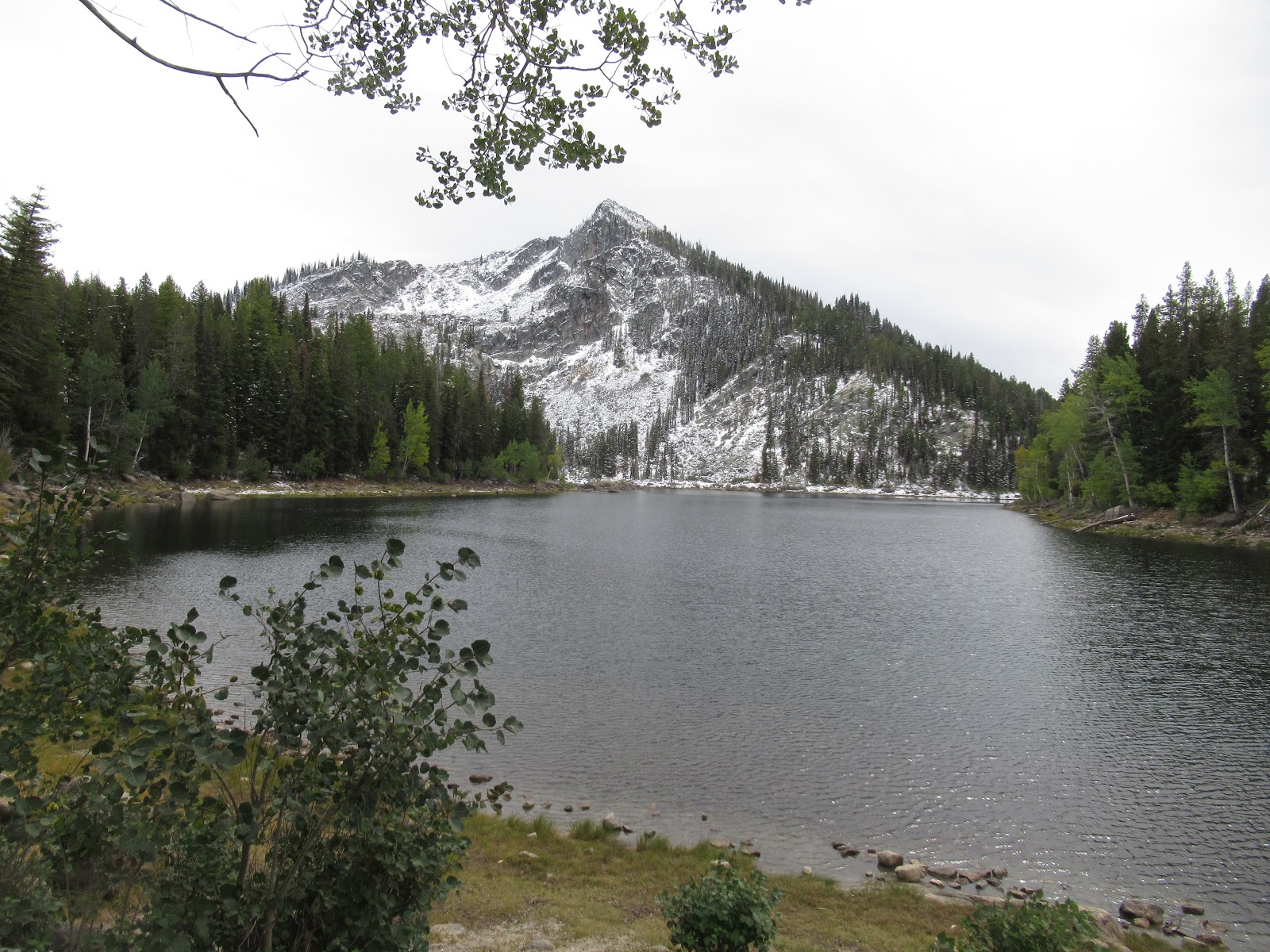
 |
| C.J. at Duck Lake |
Payette Lake. Beyond that, the road was unpaved and
rather rough. We stopped at East Fork trailhead (at about 5400 ft) just beyond
the same-named campground. I thought that this was the trailhead for the
Snowslide Lake Trail, but a couple of trail runners told us that the shorter
trail to Snowslide was up the road a few miles. When we got there (at about
5900 ft), we found that the first obstacle was a stream fording. I found it not
too challenging as there were rocks placed a reasonable distance apart. C.J.
did mot agree that the distance looked reasonable. Plus the trail on the other
side of the creek looked pretty snowy. We decided to continue on up the road as
far as the 6900ft Lick Creek Summit. Naturally, the snow started coming down
heavily as we pushed on. There were only a few places where it was sticking on
the road so we continued to the top and then down another 1.5 mi to the Duck
Lake and Hum Lake trailhead (about 5500 ft). It was still snowing as we geared
up in waterproof jackets and boots and headed along the relatively gentle
trail. The trail description must have been outdated because the few creeks we
crossed all had bridges; no slippery logs or stones this time. It took longer
than a half hour to hike the mile-and-some to the lake (5800) and the snow was
3-4 inches deep in places, but certainly did not require snowshoes. At times
the snow was coming down in almost blizzard intensity, and then at the small
lake we got a few minutes of clearing. Concern about the road conditions kept
us from stopping for lunch as it started snowing again. We were back at the car
in less time than it took to get up, and I scooped the snow off the cockpit
covers (Yes, we were still toting around the kayak). We stopped alongside the
road on the climb back to the summit during a lull so that we had a view while
we ate lunch. Then we drove back to McCall where the afternoon showers were
over and there was some sunshine. We took it easy for a while and then went
over to the pool to use the hot tub which warmed us right up. We had had enough
exercise already so we did not take the bikes out for a short ride. Wednesday
is supposed to have the best weather of the week so we will ride or paddle or
both then (hopefully). Meanwhile C.J. had taken the meat off the carcass and
started a chicken soup in the crockpot we had brought along. I had gone over to
the office to read the trail descriptions in the office copy of a guide
published in 2000. C.J. roasted our beets from the garden with a carrot and we
had some rotisserie chicken.
2 Oct, Wed – Ginny texted from Winnemucca that she and Wally
were checking out and would be in McCall in time to take us out for dinner. It
had snowed again overnight. The roads were still too warm to get any coverage
but the car and kayak had an inch or so and the trees in the woods were
liberally dusted with snow. It was cold and our plans to go riding were
temporarily on hold again. We frittered away the morning with looking at maps
and checking email, etc. The sun was out but it was still not going to get up
over 47 deg today according to the forecast. Around noon or so we decided to at
least drive out along the Goose Lake Road (paved, leading to the Brundage ski
area) and see what the weather looked like by the time we got to the Goose
Creek Falls trail. It was sunny and still cold when we got to the big
snowmobile parking lot that is the trailhead for trail 354 before the winter
sets in. The trail climbed a small ridge and then went down, down, down 720 ft
to a bridge crossing

Goose Creek, The Falls were about ¼ mile south from the
bridge. We ate lunch looking down at the tumbling water and enjoying the sun.
Two young men were leaving as we arrived; a couple showed up as we were leaving
so it must be a popular trail. It took about forty minutes to reach the bridge
on the way in and about an hour to climb out. When we got back to the condo the
sun was still shining and it was only 1530. C.J. checked with Ginny and they
weren’t going to get to McCall until 1800, so there was time for us to go for a
short ride. We took the bike path along Spring Mtn. Blvd to Lick Creek and then
the short distance east until the path ended. We rode back to the condo and had
a drink and some snacks. Ginny and Wally arrived around 1830 and we didn’t go
out to eat until after 1930. The Cutwater in the Shore Lodge was casual but
pretty upscale, with a view from ground level of the lake (until it got dark).
C.J. ordered a Vietnamese sandwich with Kurubatu pork and I got the bison brisket
sandwich with a real pile of tasty French fries. Later I signed up with Fed-Ex
Delivery Manager and had the Laithwaite’s wine delivery sent to Safeway Fed-Ex
on site. Two delivery attempts had already been made.
3 Oct, Thu – After a slow morning of breakfast and getting
ready, slowly, we drove out to the
 |
| Ginny, C.J. and Wally at Louie Lake trailhead |
trailhead for Boulder Lake and Louie Lake. Louie
had sounded marginally more interesting so we took the two-mile trail that led
there. First we had to cross Boulder Creek on an improvised bridge of several small
tree trunks, then the trail led up through bushes and forest to a jeep trail
that went all the way to the lake. [The jeep driver who tried to make it up the
whole way would have needed some big, knobby tires, but it was clear from
tracks in the snow that dirt bikes had used the trail recently.] It
 |
| Louie Lake and Jughandle Mountain |
took an
hour and fifteen minutes to reach the lake (1.8mi according to AirTribune and a
gain of 7-800 ft) and the view across to snowy Jughandle Peak. We had lunch on
the lakeside slope of the earthen dam before starting back down. I had fewer
issues on the way down and we arrived at the car in about 45 minutes. On the
way out we noted that the McCall Zipline operation might have people working or
zipping today. Instead of returning directly to WM, we drove into Ponderosa
State Park and took the scenic drive to Osprey Point where we had a great view
of the Narrows of Payette Lake in the hazy sunshine. Back at the condo we all
rested and had something to drink and eat. Around 1930 we had C.J.’s chicken
soup for dinner with rye bread and fruit salad. Later we had some ice cream for
dessert.
 |
| C.J. and "Sharlie" at Rotary Park |
4 Oct, Fri – We woke up to snow falling around 0730 and it
continued all morning. Wally and Ginny got going started for Montana after 0900, then
stopped in McCall to replace a headlight bulb (complicated, because on the left
side, the battery has to be removed to replace the bulb). I found out that the
Central Idaho Museum is closed for the season and the Ice Rink has a curling
bon spiel going on (“Rocktober”).
So we
just hung around the condo until after 1500 when the rain quit and there were a
few flashes of sun. We drove into town and walked west on SR55 (which has no
sidewalks!) all the way to the bridge over the lake outlet, almost to the Shore
Lodge. My goal was to get a couple of pictures of the full-size playground model
of Sharlie the Payette Lake monster at Rotary Park. On the way we stopped at a
couple of fabric/yarn shops; on the way back we went into the Manchester Ice
Rink and watched a bit of curling practice, then crossed the street to visit a
nifty-gifty store and look in at Chapala Mexican Restaurant. We got sprinkled
on while walking back but not enough to get wet. Back at the condo we tried
mixing some hot apple cider with vodka, and with tequila, and had some more
chips. Dinner was a replay of the soup with a great big heirloom tomato cut up
into it. We watched the snow coming down again. We hoped for a dry night and
Saturday so we could go do something outdoors, but probably not kayak in the
cold temperatures.
5 Oct, Sat – It was cold and cloudy when we got up and
cooked some pancakes for breakfast. Around 1000 (?) we headed off to do some
car touring since it was too cold and damp for biking and kayaking didn’t even
bear thinking about. I drove south to Donnelly where we crossed a couple of
bridges to get on the west side of the Payette River and Cascade Lake. Almost
all the campgrounds (State Parks) were closed at the north end of the lake and
only one USFS CG was open and a couple of State CGs down near the southern end.
We drove up to Tamarack resort which appeared to be undergoing a major growth
spurt with lots of construction. There are many bike, walking
 |
| C.J. at WorldMark, McCall |
and xc-ski trails
that a sign said are complimentary. We continued south on unpaved West Mountain
Rd to the south end of the lake where there are a lot of cabins once you get
out of the public lands. In the town of Cascade we stopped to see Kelly’s Whitewater
Park and The Strand, a 2.5mi bike/walking path along the river. We headed north
up SR55 to Farm-to-Market Road which took us to historic Roseberry. It was
off-season so nothing was open but we drove around to look at the school and
teacherage, the barn and Finnish church. We took Roseberry Road back to SR55
and returned to McCall where we got gas at Maverik again (2.859) – this time we
wouldn’t have to turn back before we reached Warren. There was only a short
delay on the Warren Wagon Road so we made good time on the paved road up over
Secesh Summit (ca 6400 ft) and down to the Burgdorf Jct. Then it was all
unpaved, wet, sometimes muddy, and snowy as we climbed up to Steamboat Summit.
We got to our high point of 6600’ from our last trip and then descended a bit
and went back up. The road was getting pretty slushy with snow in spots so we
were somewhat concerned about going all the way to 6900’ as the guide book indicated.
But it turned out that Steamboat Summit was only 6600’ also. The descent wasn’t
too bad and we soon were close to Warren. We stopped first at a trail leading
to the Chinese cemetery, sort of a misnomer since the bodies were all removed so
that they
 |
| Warren Hotel and Assay Office |
could be shipped back to China to be buried with their ancestors. From
there we drove along big piles of spoil from the dredges that worked the valley
for gold. Warren was every bit as old-looking as you would expect a place more
than 100 years old. We drove through what is now only a small town and stopped
at a one-room museum in the USFS Guard Station. Then we walked around the crumbling
Assay office, the Warren Hotel, and the Baum Shelter (an operating bar and restaurant).
Since it was snowing on and off (but also showing blue
holes occasionally), we decided
that we had seen enough and headed back up toward the summits before the road
could get any snowier. On the way, we were passed by a long caravan of ATVs as
we climbed (must have been 16 or more); I’m sure they thought we looked just as
strange as they did with our kayak on top of the Kia and far from any lake. We
got back to McCall shortly after 1700 and stopped at Albertsons to get som
e
grapes on sale. Back at WM we got started packing for our return on Sunday. C.J.
added cauliflower to the soup, and heated up the last piece of quiche for
dinner – “mustgos” for the last night.
6 Oct, Sun – Sunny day but pretty chilly as the car and
kayak were covered with frost. We got up around 0730 and were on the road
before 1000 MDT. The frost on the ponderosa pines south of New Meadow was
spectacular. Too bad there was so much low cloud/fog so that we could not see
the
 |
| Part of WorldMark McCall |
mountains. Later it cleared up and was sunny all the way home. We made
several pit stops to use the rest rooms and get a little exercise. We filled up
with gas at Idaho prices at a casino just outside of Lewiston (2.749) and then
turned north staying on US95 rather than going though Lewiston and Clarkston on
SR12. That took us up the Lewiston Grade; near the top we stopped at a viewpoint
on the old (1919) switchback highway. Back on the road we diverted from 95 on
195 instead of going to Moscow (should go there someday). That put us on the Palouse
Scenic Byway. At Colfax we turned west on SR26 and continued through the
Palouse until it abruptly ended at the Adams County line, not far from Washtucna.
In Othello we used Google to find an ice cream place called Ricas Fruetas and
Ice Cream. It had the usual selection of ice cream but also paletas/popsicles,
milkshakes, smoothies and other, more Hispanic items. C.J.’s strawberry-banana
milk shake was good and my Java Chip blended coffee drink was also very good.
The prices seemed very reasonable (9). No one appeared to be flying at Saddle;
not surprising since the wind was from the SE. We finally ran into Sunday
traffic just beyond Cle Elum on I-90. It was slow but moving and we got home
right after 1800, following a stop to pick up our Fed-Ex wine delivery at
Safeway (about 9 hrs, with the GPS estimating 7hr 47mn). Strangely enough, our
mail for the week (I assume) was in our mailbox even though I had received
confirmation of the mail hold I had requested. After dark, when it looked like
it might rain overnight, we got the kayak down from the car and put it on the
back deck under its cover.