September 18 - November 3
C.J. and I bought the
Aliner pop-up camper trailer just about two years ago. The two trips we wanted
to do with it were 1) drive the Alaska Highway and 2) go back East for the
autumn foliage that we remember from our years living in New York. We’re
retired, gas prices aren’t going to get any cheaper, we’ve got a trailer and a
tow vehicle; let’s go! The final deciding factor was that we had some Worldmark
timeshare points to use up and there was a five-day stretch available during
prime aspen color/elk rutting season in Estes Park CO.

18 Sep, Sun – After days of packing and preparation (not!)
we pulled out of the driveway by 0900, bought gas in Spokane and stopped again
for gas in Missoula, both at Costco – just about the last ones we would see for
a long ways. When we reached Beavertail Hill State Park MT, we found that the
camping fee had increased to $25 for just a place to park. Instead we took a
USFS road about 1.8 mi and camped in a large pullout for the night.
19 Sep, Mon – After eggs and muffins we were out by 0800
following a pretty chilly night. Continuing on I-90, we stopped for gas before
3 Forks (364.9), then turned south at Belgrade on SR 191 heading for
Yellowstone. At a lunch stop near Big Sky along the Gallatin River we saw a
mountain goat run across the road right in front of us and up a craggy ridge. Just
a few more miles down the road (much more scenic now) we entered YNP. We passed
through W Yellowstone and drove along the Madison River then turned off on the
Firehole River Drive. There was quite a bit of traffic for so late in
September. Since we had no
 |
| Peaks near Togwotee Pass, WY |
plans for staying in the park, we just drove on
through stopping at the south entrance for a sign photo and to figure out where
we should stay. We had been sort of heading for Sinks Canyon SP above Lander
but now we began considering closer places to camp. Colter Bay was a
possibility as was Signal Mtn, both in Grand Teton NP. Then we found two or three
CGs west of Dubois just over Togwotee Pass. Any one of them would put us in good
position to get to Estes Park in 8-9 hours the next day. There was some serious
construction work on the road up the 9000 ft pass, but the scenery was
excellent. Falls CG (USFS) was excellent as well with hook ups and a pull-thru
site for just $10 (Golden Access). We were early enough to do a short loop hike
to a waterfall and talk with Art and Miriam, there with another Aliner. It was
pretty cold at 8000 ft after the sun went down but I used some warm water from
the car for a shampoo. Sunset light on the peaks to the NE made for a good
photo opportunity.
20 Sep, Tue – 22
o outside
after the sun
came over the ridge. Naturally we had frost accumulation on the trailer ridge
inside. Still we were warm enough in just our sleeping bags; although we ran
the furnace for a while before we got up at 0800. I dumped the portapotti,
refilled the water bottles and headed down the mountain along the Chief
Washakie Trail toward Dubois and gas (375.9) with a stop at the Tie Hack
Monument dedicated to the men who had cut ties for the railroad. We passed through
a much-evolved (since my NOLS days) Lander and continued over Beaver Rim on US
287 through Muddy Gap (not muddy today). We had lunch just beyond that with a
view of rock layers eroded in a scalloped pattern. In Rawlins we stopped only
for gas (359.9) then went east on I-80 to the exit which would take us to
Saratoga (hot mineral springs) and to the start of the Snowy Pass (of the Medicine
Bow Mtns) scenic byway. There
 |
| G at Marie's Lake, Snowy Range, WY |
was particularly good scenery on the east side of
the 10,800 ft summit. We stopped for a short walk to Marie’s Lake, and again at
Libby Flats Observation platform. It was sunny but cold and windy; the
campgrounds looked inviting but chilly in the fall. The scenic byway route took
us all the way back to Laramie before we could hit US 287 to head south for Fort
Collins and Loveland (gas – 349.9). It was getting late as we ascended Big
Thompson Canyon to Estes Park and Worldmark Resort (1900 – long day). There was no
problem checking in and parking the trailer near our condo. We carried our
stuff inside (second floor again!) and settled in for our five-day stay. Using
the plug-in I-Bridge device we were able to check weather and RMNP day hikes on
the internet. The weather looked good. We were surprised to see gas at Safeway
in resort-y Estes Park even cheaper than it had been down in Loveland (345.9).
21 Sep, Wed – We were up at 0700 for our first day in RMNP.
First we transferred our wings and stuff from the Trooper, then made a stop at
Beaver Meadows VC to check maps. At the Entrance Station we
found that the
parking lot at our destination, Glacier Gorge trailhead, was already full and
it was only 0920 (and the ranger said that that was late for filling up!). After
negotiating an “elk jam” at Moraine Park we drove up to Bear Lake, a couple of
miles beyond Glacier Gorge TH (which was, in fact, full). There was plenty of
parking in the large lot, but it would have been smarter to take the free
shuttle which runs every 10-15 minutes.[We hadn’t really considered that
possibility since there had been no shuttle buses when we had last been here in
the spring.] There are a number of possible hikes from this trailhead, from a
stroll around Bear Lake to a climb of one of the rocky peaks. We chose to retrace
our snowshoe hike but add a

detour to Haiyahah Lake. We walked up the
mostly-paved trail to Nymph Lake then continued up to Dream Lake. It was well
that we had already decided to take the spur trail to Haiyahah because a group
of 104 (!) fifth graders plus parents and teachers were heading to Emerald
Lake, our destination for later in the day. At the high point on the trail
(before starting down to Haiyahah) there was a great view toward Mills Lake and
Longs Peak [Fortunately, a local hiker had pointed out that this spot had the
best view in the park.]. To the S/SE was the Bierstadt Moraine and below was
Sprague Lake. A ways back along the trail we had been able to catch sight of
Nymph and Bear Lakes. As we descended we reached a trail junction with an
“unmaintained” trail that would reach the Glacier Gorge Trail to Loch Vale in
1.7 mi and the GG TH in 3.6 mi. We continued to Haiyahah and scrambled up the
large boulders that rimmed the lake. Since it was too early for lunch, we
headed back to Dream Lake and then up the 0.7 mi to Emerald located in the
Tyndall Gorge between Flattop Mtn and Hallett Pk. There are a lot of spires on
“Flattop” and I got a photo of the moon setting just above them. We stopped for
lunch on some flat rocks above the lake and had to fend off the aggressive,
panhandling ground squirrels and chipmunks. On the way down, just below Dream,
we ran into a bull elk with a cow and calf right next to the trail. Back at the
trailhead, we walked over to Bear Lake for the classic view across the lake to
Hallett Pk. [We had seen a bat flying in the daylight just above Nymph Lake and
we reported that sighting to the ranger just in case it was evidence of the white-nose
disease that has been killing bats in the East.] On the way back we stopped at
Moraine Park VC and bought a guide to the park roads and a postcard. A quick
stop at Safeway (once I found the entrance) got us groceries for dinner which
we were ready for at 1700. To tide us over, I made a smoothie from some yogurt,
honey, orange and lemon before dinner. We had considered going out to Moraine
for the elk talk ranger program but we were too beat; my knee is sore, too.
Thundershower in the early evening.
22 Sep, Thu – Up at 0700 and out by 0845 for a car touring
day to Trail Ridge Road. The Fall River VC was not open when we stopped there
beneath McGregor Slabs (which I vaguely remembered climbing on during the 1965
(?) trip with Craig, Kate, John Stannard, and some other SUOC folks). We
continued on to the Old Fall River Road, a one-way, narrow, dirt road which
climbed past Chasm Falls where we stopped for photos, this time
without snow and ice. A road grading
crew caused a 15 minute delay while we talked with the flagger who told us that
the best color was over on the west side of the park near Grand Lake. That was
enough to cause us to change our plans and do a considerably longer tour. The
road was more rutted after we passed the grader, but not a problem as we passed
through fir and spruce forest and

reached a meadow – the first flat piece of
ground we had seen in a while – perfect for a short walk. As we neared
timberline, we encountered a bull elk close to the road by a patch of krummholtz
photo, left.
He settled down and gave us our first elk bugle. [We saw lots of elk while in
the park but seeing one close up and without a bunch of other tourists around
was definitely more special.] Another couple of switchbacks put us on Trail
Ridge Road and we stopped at the Alpine Visitor Center which was surprisingly
busy for so late in the season. Leaving, we turned N and W and descended to the
continental divide at Milner Pass, then to Irene Lake picnic area where we took
a one-mile walk to a viewpoint and around the lake. It was also a good spot to
stop for lunch at a sunny picnic table. Continuing down we stopped for the view
(at Farview) out S over the Kawuneeche Valley and W to the Never Summer Range. Once
we reached the valley floor, we stopped at Beaver Pond picnic area and spotted
two moose cows in the headwaters of the Colorado River (Moose! Whoo Hoo!). Farther
south down the road, we stopped at the Kawuneeche VC, then drove through the
town of Grand Lake and dropped in to Grand Lake Lodge for the view over the
lakes. On the way into town we pulled off for photos of some of the brightest
fall-colored aspens we had yet seen. Retracing our route, we parked at Coyote
TH and walked the mile out-and-back trail along the Colo. R. We returned to
Beaver Ponds along with a lot of other folks and found that one of the moose
had moved in closer. When an elk bugled while moving through the edge of the nearby
forest many people left to follow him. We stopped at Farview again to see if we
could see down to the moose in the beaver pond – nope. At a Tundra ommunities Nature Trail
we walked about ½ mile up to 12,310 ft, a 260 ft gain. At the top, we

climbed a
rocky summit to the Roger Wolcott Toll Memorial (with a compass-like direction
finder that indicated distance and direction to sites such as the Statue of Liberty)
photo, left. Along the way we
spotted a pika and, in the distance on the Trail Ridge Road, an elk jam (surprised
to see elk still up so high this late in the season). Back at the car, we drove
along past the elk harem groupings and stopped at Forest Canyon View, a short
walk leading to a vista from Longs Peak to Mt. Ida and north. Descending
steeply, we stopped at Rainbow Curve (?) which had views of Fall River and
Horseshoe Park and lots of begging chipmunks, ground squirrels and Clarks
Nutcrackers plus a Stellers Jay. We passed Many Parks Vista and continued on to
Moraine Park VC getting there shortly after 1700 for the 1800 ranger talk on
elk. We hung out for a while then took the nature trail which came out near the
amphitheater. The talk was very good. Ranger Cynthia’s theme was “Priorities” –
those of the cow elk, the bull elk, and the NPS-RMNP. At 1830 we drove down
into Moraine Park and joined the crowd watching a large but distant harem being
herded by a single bull elk. We drove farther in and found a couple of bulls
much closer and heard some bugling. By then it was past our dinner time so we
headed back to the condo with no more detours.
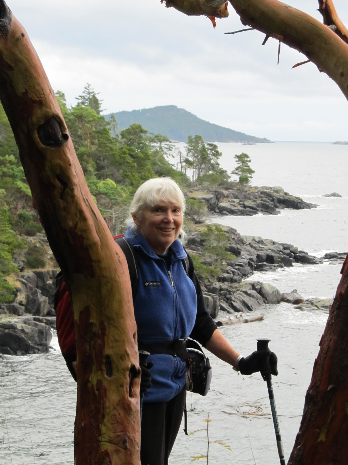
 |
| C.J. on the trail to Jewel Lake |
23 Sep, Fri – up at 7 even though we had gotten to bed late
(C.J. was up late working on some CBCC legal business) By 0830 we were on our
way to the Park And Ride (near Glacier Basin CG –closed for the season) to catch
a shuttle to Glacier Gorge TH. We began hiking at 0930 following the Loch Vale
trail through some changing aspens past Alberta Falls. A ways beyond the falls
the trail descends to the jct to Mills Lake to the left, L. Haiyahah to the
right; we went straight on toward the Loch (0.9 mi) The trail switchbacked
several times and, just before reaching the lake, we almost stumbled on a cow
and calf elk. Just beyond, the view up the lake was spectacular and we sat for
a while in the cool breeze (very welcome in the warm, sunny weather) before
heading back down again almost bumping into the elk which had moved into the
woods. Back at the junction, we climbed to Mills Lake, a much smaller elevation
gain and only 0.6 mi. Mills provided a wider view that included Storm Peak,
Longs Peak and Pagoda Mountain. We followed the trail on the left side of the
lake almost all the way to the end where we climbed onto a large outcrop to
have lunch with a view. After lunch we continued up the valley past the next
lake, Jewel. From there we returned to Glacier gorge TH and shuttled back to
our car. On the way to the condo we stopped at The Warming Hut to see if we
could exchange C.J.’s leaking Platypus (no luck; contact the mfg). Back at
Worldmark, we soaked in the spa, swam in the pool (heated to 85
o)
and talked to a couple from IL who were new WM owners. After supper we
went to an evening ranger program at the Beaver Meadow VC auditorium, “Doc
Wild’s Unhuggables”, aimed at kids but enjoyable for all. [Medical note – my
knee did not hurt me today even though we hiked at least 8 mi and gained 1200
ft – may have been the 2 ibuprofens 3x per day.]
24 Sep, Sat – We slept in a bit since we planned a rest day
with a very short local hike and then the
Beer,
Brats and Bands Autumn Gold Festival at Bond Park in downtown Estes Park. It
was after 1000 when we drove into town and found it crowded with traffic and
pedestrians. The festival didn’t look very impressive but we could check it out
later. We drove out Devils Gulch Road and found that the old TH for Twin Owls
was closed. The alternative, Lumpy Ridge TH, was not as far out on Devils Gulch
and, although not totally filled with cars, was pretty busy. We decided to do a route
which included Gem Lake and a return to the Twin Owls Loop. We were on the
trail with light packs and shorts by 1100. I guess we should have
 |
| Gem Lake |
paid more
attention to the map because what we had thought of as a short stroll, was a
gain of 1000 ft in 1.7 mi to Gem Lake through open forest and granite outcrops
(and up some of the tallest steps I’ve ever seen). Later we found out that the
trail had been constructed by the CCC. There were good, if distant, views of
Longs Peak as well as Estes Park. Gem Lake was a tiny, rock-rimmed, shallow
pond with a shore of granite pebbles. After lunch we scrambled up to the top of
one of the walls above the lake – it has been a LONG time since we have done
any climbing on granite! The trip down the trail took almost as long (longer,
since we added another 1.4 mi for the Twin Owls Loop) as the climb up because
of the many tall steps to negotiate – thank goodness we had not left our
trekking poles back at the car for the “short stroll”. Passing beneath the Twin
Owls, we saw a couple of climber access trails, one going to the Owl’s Bowels,
another to Gollum’s Arch, but saw no climbers. Just before we
reached the parking lot around 1405, we did meet a family of boulder-ers
with a very young boy who was backpacking his own “crash pad” . We were tired and pretty dried out from
all the hiking in the sun and much warmer temperatures. So we didn’t feel much
like dealing with traffic and crowds. We did some grocery shopping at Safeway
picking up milk, lettuce, bratwurst, and a fresh pineapple. Back at the condo,
I made a big fruit smoothie with orange, pineapple, blueberries, yogurt and
honey. Later I grilled the brats on one of the gas grills around the condo and
we had another good salad. Tonight’s entertainment was a ranger presentation on
the
CCC at RMNP at the Beaver Meadows
VC auditorium. We heard that FDR’s emergency legislation was hammered out
within two weeks of his inauguration, passed by Congress in ten days in late
Mar, and by May 10, workers were on the ground. [Quite different from todays’s
governmental gridlock.] Leaving the VC we encountered a solid stream of traffic
coming out of the park (It had been a “free entrance day” and earlier there had
been a big elk jam at the intersection of Rtes 36 and 66 just outside the park.
When we got back, we found that Craig had left a message about getting together
so I called him and arranged to meet at his house in Boulder Sunday after we
checked out by noon.
25 Sep, Sun – We were pretty well packed up by 1000 so we
checked out of Worldmark, leaving our trailer parked in its slot for the time
being. When we drove into Estes Park and parked by the Mohr’s winery, we found
out that they don’t open until 1230 on Sundays so we missed making that
connection with our square dance friends’ family. We walked the main drag of
the supremely tourist-oriented town checking out cabin accessories, rocks and
fossils, Nepalese clothing, t-shirts (of course) and the not-impressive Beer,
Brats and Bands. C.J. bought a card with “Elk Rules to Live By” (e.g., "Don't get stuck in a rut" ) and a
pair of bear-design socks. By then the town was filling up so we returned to WM
and hooked up the trailer and started to head for Boulder. Just then Craig
called and said he was going out on a bike ride with his twin boys and couldn’t
meet us until 1500 or so. We decided to leave anyway and take the scenic route
(Rtes 7 and 72). Right after getting out of EP we could see that even over the last
day the aspens had become more colorful and in places were near their peak. Right
near the Longs Peak Ranger Station there was a big grove of brilliant golden
aspen on the mountainside. We thought we’d see what things looked like from the
RS and TH and maybe take a short hike. When we got there, we found the parking
lot overflowing with no place to turn around with a trailer. We had to unhook
and manually turn it around; fortunately the lot was pretty level.

Back on the
road, the patches of gold got more numerous. We pulled into Wild Basin but
there was no ranger at the entrance station to ask about parking and trailer
turnarounds so, “once bitten, twice shy…” we returned to Rte 7 and didn’t stop
again until we pulled into an USFS CG at Peaceful Valley for lunch (an okay CG
but no great views). Farther south, beyond Ward, we came upon an “aspen jam”
with lots of cars pulled off the road so the occupants could admire the swath
of gleaming, gold, sunlit aspen in the valley below. We took some photos as well
but they will probably not show the reality of the glow. Descending to
Nederland, we turned and followed Rte 119 down the canyon passing many hikers
and rock climbers (full parking areas). The GPS led us right to 165 S 33
rd
and we unhitched the trailer right in front of Craig and Liz’s house. Liz got
back before Craig and invited us in. The boys (Eli and Isaac) arrived a few
minutes later and Craig was right behind them. After refreshments, Craig took
us up to NCAR Mesa for a short walk to view Boulder and the mountains (Devil’s
Thumb, The Maiden, the Flatirons, …). Then he took us to the Boulder
Chautauqua, now a Boulder city park where he and Liz were married. Back at the
house we agreed that it probably would be (after all we had no idea) fun to eat at the
Dushanbe Teahhouse, a gift from Boulder’s sister city in Tajikistan. Great
food, not terribly expensive, and a very interesting building (which arrived in
200 crates and had to be reconstructed by Tajik craftsmen. The return gift from
Boulder was a Cyber Café!) After dinner (lamb kebobs/shashlik w/Basmati rice
and a Mediterranean salad we shared) we walked a few blocks to the pedestrian
mall and then returned home.
26 Sep, Mon – We got up at 0745 thinking to stay out of
everyone’s way until the twins got ready for school, but they had a late-start
day and Craig had made waffles so we ate while everyone tried to carry on as
usual. After the boys and Craig left we took showers and said goodbye to Liz
who had an a.m. meeting. Then we checked email, hooked up the trailer and were
gone by 1000. We stopped for gas at Costco in Superior (337.9!). We avoided the
toll road by driving through Broomfield to I-76, then stopped at a couple of
rest areas and got gas again at North Platte NE (355.9). The next Passport
America (PA) campground
 |
| Sand Channels SRA, Neb |
was a long ways off so we figured we’d stay at Walmart
in Ft Kearney. But C.J. looked through the NE tourist guide I picked up at the
Welcome Center and found a State Recreation Area (Sandy Channels SRA) at exit
263 west of Odessa. It was practically empty and there seemed to be no fee. We
parked in a grassy turnout and took a walk around the park catching some great
light and reflections in the sloughs before going in to cook dinner. [C.J.
reminded me of a few other sights during the day: we saw some large white birds
with dark trailing edges (maybe Sandhill Cranes?) circling over a lake near the
CO/NE border. We also saw a flock of turkeys in a field next to I-80. And we tried
to find a display of carved (and some bronzed) trees in Sterling but we never
saw any despite a longish detour – should have asked for directions at the VC.]
27 Sep, Tue – Woke at 0730 and we were on the road by 0900. Basically
we drove all day with a stop in
 |
| Amana Colony Meat Market |
Omaha at Costco for gas (325.9), a half-case of Boulevard
beer and lunch. We picked up an Iowa tourist book at the first rest area and
stopped once more as traffic backed up due to a lane closure being removed at
1645. Along the way we decided to stay at a PA CG in Amana so got off I-80 at
Little Amana and drove approx. 11 miles to Amana RV Park, a large, mostly
treeless RV park with good, level, pull-thru sites and hot showers in a heated
building. The $15.42 included a wooden nickel good for getting a pound of
bratwurst at the village meat market.
28 Sep, Wed – From the RV park we drove into Amana where
cashed in our wooden nickel and got a pound of maple brats for $1. Then we
followed Rte 151 to Cedar Rapids, apparently home of Quaker Oats, and picked up
a Minn-Wis AAA Tourbook along with a more detailed map of the Upper Peninsula,
and filled up with gas.(339.9). We continued on 151, a four-lane divided hwy
through Dubuque and into WI. At the first rest area there was no one on duty at
the VC and this time there were no useful booklets similar to those we got in
NE and IA. Oh well, we had the Tourbook. As we drove NE, then N into more
 |
| Trolls at Mt Horeb, WI |
forested land, the fall colors began to show reds mixed with the yellows. There
were still a lot of conifers but the hardwoods were definitely changing. We
were lured off the highway by signs for the 150
th anniversary of Mt.
Horeb and the carved trolls. We walked along the main street taking pictures of
the trolls and stopping at the Duluth Trading Post flagship store (which had
taken over the location of the Mustard Museum). After a little wrong-turn mix-up
near Madison WI, we turned onto I-39 to head north. Our original destination in
the UP had changed when a neighboring couple from MI at the RV park had said we
couldn’t miss Porcupine Mountain State Park filled with old-growth hardwoods
sure to be colorful. C.J. did a lot of research on camping options on the way
up I-39 – PA RV parks, USFS CGs, other RV parks - but we finally settled on
driving until sundown and staying in a Walmart lot in Rhinelander. We took a
break around 1630 at a Culvers (frozen custard) in Stevens Point. That was
after we had stopped in Westfield to see if we could say “Hi” to Danny and
Brian at Danny’s Campers, but the shop (much smaller than the huge one in
Coloma) was closed. We filled up with gas at a Marathon station there (same 10%
ethanol, low-mileage gas we’ve been using since North Platte NE). At
Rhinelander we parked in a level spot adjacent to a cemetery and got some
groceries and supplies at Walmart.
29 Sep, Thu – There were low clouds as we awoke at 0700 –
the first sign that our good luck with weather was about to change. We were on
the road by 0845 heading east to Laona and into the National Forest
 |
| Presque Isle R in Porcupine Mountain State Pk |
where we
stopped at a ranger station. From there we drove north through Nicolet NF. Turning
west and northwest we left the NF heading for Ontonogan. We stopped at an Ace
Hardware in Iron River to replace the hitch pin for the tongue wheel. Then we
got gas (352.9), possibly “real” gas not ethanol, in Watersmeet. Both locations
had broken wild rice 3 lb packages for $9.99 (unbroken - $16.99) but we didn’t
buy any expecting to have many more opportunities, and maybe at a lower price. The
weather had deteriorated to rain and wind by mid morning as predicted. It was
only a few more miles to Porcupine Mtn Wilderness State Park where the rain and
wind really picked up as we were on the shore of Lake Superior. There was no
electricity in the visitor center but we talked to the rangerette about camping
and found it was $25 right on the lake with hookups and $14 at primitive sites
farther inland. Plus the $8 entrance fee! It was too stormy to hike so we
searched AAA and the GPS for other options – about 40 mi from the VC was a
municipal CG at Wakefield which was $12 (in 2009, $15 now) with hookups. That
seemed like a good deal and it allowed us to drive through the park on the way
there. At Wakefield we maneuvered the Aliner to face into the wind then set it
up as quickly and efficiently as possible in the rain and wind. Not much rain
got in but our outer clothing got pretty wet. We climbed in about 1630 or so
(EDT, we’d crossed the time zone in MI) and ran the furnace to dry our stuff
and keep us warm. We couldn’t run the fan because we were concerned that the
wind gusts might damage the vent cover, so we had lots of condensation inside
on the windows and exposed aluminum. We had brats (again) with zuke and pasta. What
with the rain, wind, and dropping temperatures, we ran the furnace quite a bit
until we went to bed. Around 1845 there was a colorful sunset across Sunday Lake, and most of the rain and wind quit. It didn’t get as cold
as we had predicted (we had the down comforter out) but the stars were visible.
And that was it for inclement weather until we got all the way to NH.
 |
| Lake of the Clouds, Porcupine Mtn State Park |
|
30 Sep, Fri – No one else was camped at Wakefield so I had
the bathroom to my self as I used heated water to wash my hair – a quart seems
about right if I use a sports bottle cap to control the flow. We left the
trailer ready for travel at the CG and drove back to Porcupine. First we went to
the Presque Isle Scenic Area (SW corner), paid the $8 daily fee and started
hiking from the backpackers TH down the E side of the Presque Isle River to
Lake Superior where large waves were breaking on the sandy beach just like
an ocean. In intermittent sun we hiked back up the west side of the river
passing several falls stair-stepping down over the Nonesuch Shale. After a bit
more than a mile we came out on South Border Road and crossed the hwy
bridge to the Eastside Trail. This one had boardwalks and stairways but it was
also good for views of Manido (cf, Manitou) and Nahawaha (?) Falls and the
colorful foliage. From Presque Isle we drove to the Summit Peak Scenic Area and
walked the ½ mile to the 40 ft observation tower. It was pretty windy at the
1958 ft elevation but we had dressed for it so we enjoyed the walk and bright
foliage, especially when the sun hit it. Lake of the Clouds SA was our next
destination, a favorite Michigan postcard subject. On the way we stopped at two
CGs, the tiny (3 sites) Lost Creek Outpost and the main Union Bay CG. The views
at Lake of the Clouds were as good as advertised, especially with the fall
foliage. The escarpment (which gave its name to the Big and Little “Carp” Lakes
and to the lake itself at one time) was basalt (trap rock) over sandstone over
shale. Having seen all we wanted to at Porcupine, we drove back to Wakefield’s
Sunday Lake Campground and picked up the trailer in a rainbreak (after cleaning
off a bunch of goose poop from the roof). We looked at PA CGs on the GPS but
decided to go to Marquette and stay at a Walmart (about 130 mi, arrived 1830). I
got really low on gas after turning onto Rte 41 when none of the small towns on
the route had a gas station. Finally in Michagami we were able to fill up (359.9)
and found out that all those 50 lb sacks of apples or carrots or sugar beets
were for sale as “deer food”. In Marquette the GPS sent us past the Walmart to
a non-existent WM. We returned to the actual WM, parked and bought some groceries
and had another good dinner. The temperature reading from local banks' signs
were showing lower forties so we were expecting a chilly night. Without an
electric hookup we weren’t sure how much we could operate the furnace before
running down the battery. [This was before we found out that our battery was
almost dead.]
 |
| Chapel Rock at Picture Rocks Nat'l Lakeshore |
1 Oct, Sat – We didn’t wake until almost 0800 but we were on
our way by 0845 to Munising. We stopped at the Pictured Rocks National Lakeshore
(PRNL) info center and picked up maps and brochures for hiking (and looked at a
book of Longfellows complete
Song of
Hiawatha, much longer than the excerpt we all had read as high school
students in one anthology or another, which was set in the PRNL area, Gitchee
Gumee being Lake Superior). We then went directly to the 8-site Little Beaver
Campground which was three miles off the highway on a “steep, winding” gravel
road. We chose a site next to the lake and used the FRS radios to help back in.
After unhooking and setting up we drove back to the Miners Castle area to see
that iconic PRNL sight. Backtracking a couple of miles on the same road, we
parked at the over-full Miners Falls TH lot. The hike was a 1.2 mi RT nature
trail and it wasn’t as busy as we expected. We had lunch on the way to the next
site – the Chapel Rock/Mosquito area. Once again the parking lot was
overflowing, obviously a popular place (especially on a Saturday). We started
on the loop in a counterclockwise direction (6.2 mi+) at 1500 and got back at
1800 (still plenty of daylight). We passed Chapel Falls but did not really get
a view of Chapel Lake until our return trip. We came out on the shore of Lake
Superior right at an eroded “sea stack” whose only connection to the rest of the
cliff was the thick roots of a white pine. We walked a short ways on the sandy
beach then returned to the forest for the last leg of our loop. When we got
back to Little Beaver camp, I checked the voltage on our trailer battery –
10.46 – so it had not charged at all on the 50 mile drive from Marquette
(Uh-oh!) C.J. made a quinoa, black bean, tomato, and sausage dinner and I built
a small fire – the only warmth we’d have that night since we couldn’t run the
furnace until we got it charged up
 |
| Spray /Falls at PRNL, Lake Superior |
2 Oct, Sun – It was pretty cold in the trailer – in the 30’s
– and even colder outside with frost. We got up about 0800 but didn’t get on
the trail until 1000. It was another beautiful day, and got warmer. We hiked
down to Lake Superior and followed the North Country (National Scenic?) Trail
west along the tops of the cliffs along the coast. [The beach where we came out
of the forest looked walkable but a ways farther on headlands stuck out into
the lake and would have necessitated a climb back up to the trail anyway.] It
was another 2.5 mi to the Spray Falls viewpoint and we got there just at noon,
time to stop for lunch before retracing our route. There were a few sharp
ascents and descents along the way, some with very tall steps (shades of Gem
Lake!). Back around Little Beaver Lake there were long boardwalks over wet
areas. We met a number of backpackers and some day hikers but not as many as we
expected based on the number of cars in the parking lot. Back around 1400, we
packed up and got on the road deciding to find a PA CG so we could be sure of
electricity to charge our battery and/or run the furnace if we had another cold
night. We backtracked a bit to a paved road running south from near the Bear
Trap Restaurant although the GPS kept wanting us to take dirt roads down to SR
28. While I was pumping gas (359.9), C.J. called the PA CG in Newberry but it
didn’t take PA after 9/15 so we drove on to I-75 and south to Kinross where the
municipal CG cost only $10 with PA. We got showers and enjoyed a sunny evening
(Battery showed 13.36 when we arrived but that may just be surface charge; at
least we know that the converter/charger is working) It didn’t get quite as
cold so we could work on our computers without freezing or running the furnace.
C.J. called Keith Riemersa about flying tomorrow or ? at Green Point but he
lives 160 miles away and does not fly weekdays. He said he would call back with
another pilot’s tel. number; he lives only a mile away.
3 Oct, Mon – Keith never called back so we went to bed not
knowing where we should aim for on Monday. It wasn’t too cold so we didn’t even
unpack the down comforter. We got up at 0800 and were on the road after a short
stop at a grocery (still looking for wild rice…) around 1000. We took the
business route through St. Ignace and picked up a loaf of walnut-cranberry
bread while still looking for wild rice – last stop on the UP. After crossing
the Mackinack Bridge ($5.25) we stopped at a VC. About 30 mi down I-75 we
detoured on to SR 31 and followed it south along the edge of Lake Michigan/Traverse
Bay. We stopped at a roadside picnic area for lunch, a fruit stand to buy
apples, then continued south to Traverse
City. We found a AAA on our route and
picked up maps for NE and SE USA. I failed to stop for relatively cheap gas
before heading out to Sleeping Bear Dunes NL, but we stopped at another grocery
store to
 |
| Sleeping Bear Dunes (launch) |
restock our cheese and buy a meat pasty and yogurt. We checked in to
DH Day CG in SBDNL, dropped off the trailer and then drove to park HQ in Empire
to see about getting flying permits. The VC was already closed, but we found
gas (341.9). We took the Pierce Stocking Scenic Drive and walked out on the
dune – no howling wind like the last time we were there
photo, left. We also went to the
Dune Climb area where C.J. did the climb while I checked out a nature trail at
the base. Back at camp C.J. made dinner while I checked the battery which was
already down to 12.2 (50%) added some water and plugged in the charger. After
dinner we walked over to talk to Dick and Diana Barrel from MN who had a 1997
Aliner. They do most of their cooking and cleaning up outside and have a “Mr.
Heater” propane catalytic heater which they really like (might be a good
alternative to our propane furnace if that is what is running down the battery). While
we were talking in the dark, a raccoon climbed right up on their table to
see if any food was left in the washed dishes! Later they came over to see our
little trailer and we sat around and talked for quite a while. Later I noticed
that our door wasn’t closing easily and removed the strikeplate which had at
least one stripped screw.
4 Oct, Tue – Measurements of around 10.5v made me worry that
the battery was not holding a charge. I planned to get a test done sometime
soon. [Also, the Trooper’s Check Engine Light came on and went off yesterday –
hope it was just a fluke.] Not sure what we should do today, we headed first
for the Bayview
 |
| C.J. hiking along Lake Michigan Shore below Green Point |
trailhead on Thoreson Rd. Skipped that and went to Pyramid
Point instead, a 1.2 mi RT walk to a (launch and) viewpoint looking N over Lake
Michigan toward Manitou Island. We returned to camp to pick up the trailer to
go to Green Point since Bill Fifer said he would be there at 1100 with a
student. We got there (From Elberta go S to just over the crest of the hill,
turn right on unpaved Ellsworth Lane. At fork where right branch goes down
hill, take left fork in to “Stop.No Trespassing.Private” signed area and
immediate next right into a road signed “Green Point Members Only”) around 1300
and Adam, the student, had not yet arrived. We had lunch and hung out with
Bill. Conditions were light and crossed from the S. When Adam arrived we
watched him launch and as expected it was not soarable. Nevertheless, it was
launchable so we got ready to go and before Bill returned from picking up Adam,
I launched. Hope springs eternal, but I sank like a rock as I tried to get as
far down the beach toward Elberta as possible to shorten the hike. C.J. landed
a bit farther north on the same grassy bench above the beach. We walked for
what seemed like a mile not sure how we would recognize the end of Grace Road
where Bill had offered to pick us up. Finally I spotted a street sign and
climbed up a steep track to the road end then went back for C.J.’s wing. Bill
arrived just as I got back to the street. Adam had not flown again. (Bill, who
is turning 70 in Nov) was sort
 |
| Green Point sunset |
of put out with Adam for spending so much time
“ironing“ his wing, and finally told him to bag it up. It was sunny and warm
and flying conditions had not improved so I washed my hair and we hung out until
time for dinner around 6. [Earlier we had decided to stay at Green Point for
the night. There were CG-type electrical outlets – but no water - and grassy
parking spaces as well as a roofed picnic area. Since we had signed waivers and
paid the $10 fee for each of us, camping was free. [Adam was also camping but in
a tent.] We had some chips and guacamole (still good after being carried from
home all this time) before spaghetti and salad. After cleaning up we went up on
the HG ramp to watch the sun set into Lake Michigan. The rest of the night was
relatively warm.
5 Oct, Wed – Up at 0800 and out by 0930. Nice drive across
MI with lots of color on diagonal SR 115. We stopped in Cadillac to get an
Ontario Tourbook at AAA (small shop; did not have a campbook), Then we went to
an Autozone and had the battery tested – “Bad, bad, bad”, she said. Well, I
should have guessed that was the problem. 25 of the 30-months warranty had gone
by so we would have received only a 10% credit even if there had been a Costco
anywhere nearby. We ended up buying a new battery at Walmart for $68 (plus
tax=$74) (cheaper than the $95 one at Autozone). We also priced propane
catalytic heaters just in case we found out that our propane furnace was
destroying the battery. They cost about $85 for the Mr. Heater Buddy, and $58 for the Coleman Black Cat. We bought some groceries
before we hit the road again. Gas near Frankenmuth was $319.9, just about a
record low. We also stopped at a Culvers for an afternoon snack. Good thing we
did because there was a laundry available at the St. Claire Thousand
Trails/Encore Resort, a PA RV park and, after showers, we spent until 2130
getting two loads of dirty clothes washed and (mostly) dried before we stopped for dinner. During all that
time we were slowly collecting our email and sending messages to Kate, Craig
and Wayne. C.J. checked out the Mt. Brace flying site on line and found out that it was
kind of expensive and a 35-min hike to the launch after the 30 min drive
(wonder how those HGs get up there….) She sent an email to James Bradley to see
if he had any ideas about where to fly. I paid MNBA on line via Bill Payer and checked
that our Soc Sec checks had been deposited for Sep. We would have to check in
at the office in the morning because the attendant who checked us in did not
have access to the check-in computer. The RV park was large but the sites were
shady; we had a back-in with elec. But the water had been turned off for the
season.
6 Oct, Thu – Up at 0800 again then out of camp late after
checking email and trying to get the office computer program to accept the PA
discount. We stopped to top up gas (345.9) at the entrance to I-94 then drove
to the border crossing (Blue Water Bridge, $6) in Port Huron. Driving across
this stretch of Canada was nothing special but cut off a long drive through IN,
OH, PA and NY mostly on toll roads. We stopped for lunch at a “service center”
which had a gas station and an airport-like food court with BK, Horton’s, a
stand specializing in
poutine (CDN dish consisting of French fries and cheese
curds covered with brown gravy), a Starbucks and a few more. We ate outside on
a fossil-studded boulder. Before going all the way to the border crossing at
Niagara Falls, we turned off on a route that took us to Niagara Falls-
 |
| Brock Mem.: a British Soldier uniform of 1812 |
|
On-The-Lake, a decidedly high-rent tourist destination on Lake Ontario. From there we
followed the Niagara Parkway along the Niagara River stopping once to stretch
our legs and get a picture of the river and the Rainbow Bridge. We also took a
longer stop at a park in Queenston where a 165 ft monument built in 1853 to
General Sir Isaac Brock commemorates his death at the Battle of Queenston
(10-13-1812) when American forces were repelled forcing a withdrawal from the
US invasion of Canada. We had an interesting conversation with a graduate of a
local college, uniformed as a British soldier of the 1800s, about the War of
1812 and the impact of the abdication of Napoleon after his defeat at Moscow. Then
we drove to Niagara Falls where I dropped C.J. off to take some photos. Driving
around the block to pick her up was not as simple as I thought it would be but
I eventually got back to where she was waiting. We continued along the Parkway
to Fort Erie and crossed the Peace Bridge to the US border. Driving on I-90
through Buffalo was bumper-to-bumper slow-going. Once on I-90 going southwest we checked
the GPS for a Walmart on our route toward Bath but found none (!), so we
decided to head for a PA CG in Java Center. They did not answer the phone when
C.J. called from a gas stop (363.9) in E Aurora. A new check of the GPS now
showed a Walmart in Warsaw 24 miles E so we had a new destination. The route was a continuous series of ups and downs as we traversed land scraped by glaciation. A produce
stand along the way provided us with corn, pepper and a Danish squash. WM had
no fresh food store so we bought only oatmeal and a bag of trail mix. However,
the Tops next door had rotisserie chicken and some good bread so we had another
great meal.
7 Oct, Fri – We stopped in the Save-a-Lot store in Warsaw
and got two boxes of Triscuit substitute (for $1.69 ea). Then we tried parking
outside the public library to use their wi-fi but their system required a

library card number. We headed on east to Letchworth State Park ($8) where we
stopped at a number of overlooks and had lunch at one seated on a dry-laid,
flat stone, rock wall. At Lower Falls we parked and checked out the CCC
Memorial – same statue that we had seen at Deception Pass, WA. Then we walked
the 3/4 mile trail and down the 127 steps to the CCC-constructed bridge in the bottom of
the gorge with a view of Lower Falls. The bridge had withstood many floods over
the years and was still in excellent shape. Next we stopped at Inspiration
Point, then parked below the museum and the Glen Iris Inn, and walked to
viewpoints for Upper Falls, Highbridge (a railroad trestle), and Middle Falls
(rainbow). Leaving Letchworth by the Portageville entrance (S) we drove on to
Bath where we got gas (365.9) in an area busy with traffic. We got to Kate’s
house (built in 1900) about 1630 and, after visiting a while, she took us up to
Mossy Banks Park where we walked down to the hidden HG launch. George Dickey
met us there in the parking lot and we went to dinner at San Carlos Mexican
Restaurant. Back at Kate’s we contacted Kate’s HG friend Scott “Weezer” Wise
(?) and a couple others to see about the possibility of flying in the Southern
Tier the next day. The forecast did not look good for local sites including
Bristol Mtn (across from the ski area). But we could check again in the
morning.
8 Oct, Sat – Up a bit before 0800 as usual. Kate made cheese
and fresh herb omelet. Later she drove us to Williams RV where there was an
outdoor expo going on. We avoided the $5 per car fee since we were there just
to fill our propane tank. . It took 3.4 gallons (at 80% fill, it should hold 4
gal) for about $12.35.
 |
| In Bath with Kate R |
Back at Kate’s I checked email and answered Lauren’s and
Wayne’s. The weather looks good until Wed when a storm is predicted. C.J. and I
decided to blow off the Rochester Area Flyers graduation party at Bristol, and
C.J. checked with “Voiter” about Ellenville. He said it was very light (and
later we heard it was over the back… but, then again, on Sunday it was
awesome). So we chose to go to the Adirondacks for Sat and Sun and head on to
VT to visit Lauren and Peter on Monday. We drove up the east side of Keuka
Lake, had lunch at the head of Seneca Lake, and finally gave in and took the
Thruway as far as Rome where we stopped at a Bank of America to replenish our
cash. Heading on toward Old Forge, we got gas at Holland Patent at a Stewarts
(365.9) and stopped at a closed info ctr so I could look for PA CGs on my
laptop. We chose Kayuta Lake CG in Forestport. It meant stopping early (1645)
but gave us time to enjoy the camp in the afternoon sunshine and to do some
computer stuff. There was an end-of-the-season potluck at 1800 but we weren’t
prepared to contribute a dish so we had chicken and pasta with salad with fresh
fruits.
9 Oct, Sun – Travel was relatively slow but scenic as we
entered the Adirondack Park. We drove a mere 150 miles and a good bit of that
was slow going through villages like Old Forge filled with folks on the same
mission as we were, leaf-peepers all. We stopped for gas in Tupper Lake (367.9)
and bought some bread and pasta at an IGA. I’d been hearing “brake noises” at
least since the day before and today they got very noticeable – maybe it was
because it was warm and we were driving slowly through a lot of towns and
villages with the windows open. Anyway, when we pulled into camp (Fish Creek
Pond State Park CG near
 |
| Mt Baker across Moody Pond |
Saranac Lake) early (1300), I pulled the wheels off one
at a time: nothing obvious except that the pads were really worn thin. We had
lunch, a second round of Kate’s sandwiches; then we left the trailer and drove
in to the town of Saranac Lake to do a short hike. It was a bit of a challenge
to find the trailhead because there was no “Moody Pond Rd” but we followed
a road to Moody Pond (Thanks, GPS.) and
found a bunch of cars parked at the TH (just as we had seen at other THs along
the way from Forestport to camp). The trail was a steep 0.9 mi ascent to a
rocky ledge on the top of Baker Mtn. C.J. timed us at 35 min up and 1.5 hr for
the whole trip (We came back down via a different route). We had great views of
the lakes and the distant High Peaks area. There were good if somewhat subdued
fall colors. On the way back we drove through Saranac Lake to see if there were
any auto repair places; we found two and the GPS listed several more. Back at
camp, the solar shower had not had enough solar so we heated some water for an
outdoor shampoo and indoor sponge baths. We were camped at a DEC park – cost
was $22 plus (we didn’t know this) $5 for non-residents,
plus a $2.75 registration fee =$29.75! We could have stayed in a
local non-PA RV park for $30 (with showers and electricity probably). Oh well, our
site was right on the lake and it was very scenic.
10 Oct, Mon – We were up at 0645 so I could call Monro at
0730 when they opened. They could take us at 0830 so we had a quick breakfast
of instant (ugh) oatmeal. We were still ten minutes late but early enough that
they were able to replace the brake pads and rear rotors by 1115 (for a mere
$600). We spent the interim walking around Saranac Lake (on the street and on
the riverfront trail), bought postcards, and visited the cottage where Robert
Louis Stevenson spent a winter. Once we had recovered the trailer from the boat
launch parking lot across from Monro we headed east into the high peaks passing
through Keene (reputedly hit hard by the Irene storm). At lunch time we stopped
at a day-use area between the Cascade Lakes. It was amazingly uncrowded
considering that all the roadside pullouts for trailheads had been parked up
fully.
 |
| G at Owlhead Overlook, Adirondacks |
Then we turned north toward Elizabethtown and drove past the (full)
parking lots for Baxter Mtn and Hurricane. The parking lot (off road) for Owls
Head/Giant was small and required backing the trailer in order to get turned
around. The trail climbed fairly steadily but not too steeply until the last
0.2 mi. Otherwise we followed a nice stream through birch-beech-maple forest. The
view from the windy, rocky summit ledge was excellent – good color, Rocky Ridge
and some of the back-side slides on Giant. It took 1.5 hours to climb the 2.6
mi trail and about the same going down. We started at 1310 and got back to the
TH around 1630. Then we drove through Elizabethtown to Westport where we could
get cell coverage to call Lauren and Peter. We got their address and drove to
Crown Point where we caught the free ferry across the bottom of Lake Champlain
into Vermont. [Awesome sunset and moonrise!] In Bristol Lauren and Peter welcomed
us to their renovated 1900 house which was much larger than the picture made it
appear. We sat around their totally remodeled kitchen with drinks and snacks
and a typically wonderful Lauren dinner (following a post-hike shower) and
tried to get caught up on the 30 (?) years since they left Seattle.
11 Oct, Tue – I woke up in time to see a red-tinged sunrise sky
from the window of our room. Later I did some bill paying and checkbook
balancing – looked okay. We had a breakfast of scones, egg scramble with
veggies and goat cheese, real cocoa and OJ. Lauren took us for a walk through
Bristol – yes, it’s that small – it’s easy to see why they decided to move
here. We threw some of our sweaty clothes in with a load of laundry Lauren was
doing and, when it was mostly dry, spread it out in the car. We left around
1215, got gas (340.9) in Middlebury and drove over the Middlebury Gap (~2100
ft). Along the road (and by the asphalt patches), we could see evidence of the
destruction caused by Hurricane (Tropical Storm) Irene. It was even worse on
the east side of the Green Mountains in the White River Valley where we saw
houses partly buried in river silt – lots of erosion and deposition. We were
ready for lunch but all the roadside/riverside pullouts were gone or under
construction, so we did not stop until we had passed through Woodstock. After
lunch we drove over a bridge over the Quechee Gorge, very deep (and swarming
with tourists). Eventually we got
 |
| Morningside Flight Park |
to I-89 and took it south to the bridge over
the Connecticut River and on to Claremont, NH. We were surprised that there
were no signs with directions to Morningside Flight Park, so we had to stop at
a visitor center. Once C.J. had an address, I was able to look it up on Google
Earth and also set it as a destination on the GPS. When we got there a HG was
flying but the wind was calm to over-the-back. Two or three pilots were doing
sledders from the 250’ and 450’ (top) launches, and later a Dragonfly towed up
a couple of tandems. We could have
camped there for $10 per person but decided that we would get the same
amenities for free at Walmart in Claremont [Local CGs were about as expensive].
The counter person at WM thought that the manager had said “no RV overnighting”
so I had to speak with the manager. What
the manager had actually done was refuse overnight parking to a trucker, RVs
were okay. We picked up a jar of PB and some porta-potti deodorant at WM. Earlier we had stopped at a roadside fruit
stand and left $3 for three pounds of apples. That evening we discussed where
we should head next. I thought it was too soon to head for Cousin Rick in MA,
E-ville, Greg, Pat and Kitty Hawk since camping sounded uncertain on the Outer
Banks. During the day I called Scott Badger in North Conway and he said he’d show us
around the old Whitehorse Ledge flying site or at least have dinner with us if
we came up his way.

12 Oct, Wed – We decided to head up into the Whites before
the rain hit (predicted for Thursday).
We didn’t get out of Claremont until close to 1000 and then traveled leisurely
up Rte 11 winding through small mill towns and forest. We bought gas at Newport (345.9) just to top up
at the lowest price we’d seen in a while. Of course, the next gas station had gas for
336.9) – oh, well! At another stop I called Rick and got him at work. We’ll stay with him and Kathy on Thursday
night. I-97 took us to Lincoln, the west end of the Kancamagus Highway (Rte
112); and the big USFS/Lincoln Tourist Center. There were good
 |
| Rocky Gorge, Swift River NH |
history displays
and we picked up a map of the Kancamagus. Heading east we stopped at several
overlooks and, at Swift River Gorge, we took a one-mile walk around Falls
Pond. The infrastructure around the gorge
looked like it had taken a big hit from Irene. We stopped for the night at
Blackberry Crossing USFS CG, about five mi west of Conway. Leaving the trailer around 1500, we drove
across the street to the Albany Covered Bridge and CG/TH where we took off on
the Boulder Loop Trail. It was a pretty
good climb to viewpoints from the granite ledges of the summit. The weather was
still good and the fall colors were bright. We didn’t get down until 1730 and
had had no cell coverage until we were halfway to Conway (We hadn’t thought to
bring a phone on the hike). But we managed to get hold of Scott and meet him at
the Moat Smokehouse just north of North Conway (which is now filled with outlet
malls, sport shops, motels, restaurants and boutiques). Dinner was an excellent
platter of barbecued ribs, chicken and pork and some local microbrews. Scott had lots of stories about the early
days of flying in the White Mountains, mostly from Whitehorse which has either
a cliff launch or slab depending on the wind direction and a strenuous climb to
get there, all reasons why he is the only pilot left in the area, perhaps. We got back to the CG about 2030 and got set
up quickly, not looking forward to the rain in the forecast. Still, weather so far on the trip had been
amazingly good.
13 Oct, Thu – The rain started around midnight, just as
forecast, not very hard but loud on the plexiglass skylights. In the morning we
were able to pack up in just a drizzle.
We took a little time checking out the CCC info sign before we
left. According to the map it appeared
that we had camped on the site of the old CCC rec hall. Around 1000 we stopped
at the Saco River ranger station and the ranger gave us some ideas about places
to go and things to do around North Conway in the rain. We drove up to NC and
walked
 |
| Whitehorse Ledges across Echo Lake in the rain |
through the LL Bean outlet and Eastern Mountain sports. Then we found
the Mt. Washington Observatory’s Weather Discovery Center and spent an hour
playing with the interactive exhibits and watching the movie. The weather had
not improved much but we still wanted to see Whitehorse, so we drove out to
Echo Lake State Park for a surprisingly good view. Then we retraced our way
down SR 16 to Conway stopping for bread and goodies at Leavitt Bakery, and new
windshield wipers at NAPA. Just south of Conway we took SR 25 and meandered
down along the shore of Lake Winnipesaukee through Wakefield stopping for gas
(341.9) in Alton NH. We tried to find a place for an oil change in Manchester
but WM had no lube operation, Midas was too busy to talk to us, and Valvoline
couldn’t take a trailer. Back on the road we entered Massachusetts and got on
the freeway where traffic was somewhat slow. We got off I-90 at Rte 20 and
drove west through Sturbridge and then down the back roads to Wales to my
cousin Rick’s estate. Rick let us drive on his yard
 |
| Aliner in Rick and Kathy's garden |
to a level spot since we
would be staying in the trailer - their house does not have a guest room and
the two big Labs take up most of the living room. Rick and Kathy took us out to dinner at the
Steaming Tender located in the old railroad station in Palmer. I had Bluebeard Tenders, three chunks of good
steak encrusted with coarse salt, served with bleu cheese over Portobello
mushrooms, with garlic mashed potatoes and carrots. Excellent!
After dinner we drove back through Palmer noting the missing landmarks,
e.g., my grandparents’ house. [Along the way to dinner, Rick pointed out a
swath of devastation only a few miles from his house where a tornado had
touched down.]
14 Oct, Fri – We got up at 0700 and prepared breakfast using
the microwave in Rick’s kitchen. After eating he showed us around his property
including his big tractor with its many attachments (among others, he has a
generator that hooks up to the PTO), and his big, shiny motorcycle. By 0945 we were off and heading to I-84 which
we followed all the way through Connecticut into New York. We followed Rte 32 from near Newburgh up to
New Paltz and got gas (365.9) but did not find the old deli that once had our
favorite raisin pumpernickel bread. The
Grand Union appeared to be gone, but Rock and Snow, the climbing shop was still
in business. It had stopped raining so we headed up to the Gunks stopping along
the way at the Jenkins-Lueken Orchard for some good cider. The salesperson knew what we were talking
about when we asked about raisin pumpernickel bread and told us how to find
Cohen’s Bakery in Ellenville. The color
was better on the west side of the ridge and it was warmer – in the 70s in the
sun. The GPS also had Cohen’s so we had
no problem finding it or parking on the street, running in and getting a half
loaf (a whole loaf is HUGE) and some chocolate crumb cake. On the way south from Ellenville we were
trying to spot the launch with limited success, but we did spot Hang Glider
Road and drove in to the LZ. The wind
was wrong and no one was flying but we walked over to Greg Black’s Mountain
High Shop and talked with him for a while.
He showed us a video of HG students launching from his big ramp. [We
didn’t even know that there was more than one launch at E-ville.]. Tony and
Greg each own half of the LZ having split over some difference. Greg has a big concave training hill built up
from fill, a large shop and what looks to be the worlds largest hang gliding
sign. On the way out we could clearly
see the Mountain High ramp as well as the slope where we had launched last time
we were here. We crossed into Pennsylvania (a 4-state day) at Port Jervis after
driving though a thunderstorm and continued on Rte 209 down through the
Delaware Water Gap Recreation Area. At
Stroudsburg around 1700, we found a WM with no lube so we unhitched and drove
to a nearby Jiffy Lube for an oil change.
The air filter was dirty but I banged out the bugs, bees and dirt and
re-installed it for now. We settled in at Walmart but it was pretty urban and
noisy for a place out near the Pocono Mountains. We ate some of the raisin pumpernickel bread
with sausage and a salad and had the crumb cake and cider for dessert (even
though we were parked just steps from a Friendly’s).
15 Oct, Sat – We crossed the Delaware River on I-84 then
drove back roads along the New Jersey side of the river. We crossed back in to PA and began to run
into heavy, slow traffic. We stopped for
gas and lunch in the gas station parking lot in Newcastle PA (?) then we used
the Interstates to get through/around Philadelphia. In Delaware we circled around Wilmington and
over a striking bridge with a single row of suspension cables running along the
center of the bridge. Then we exited the Interstate which was about to become a
toll road and drove south on a good 4-lane divided highway that seemed to be
just as fast. The GPS got us to Greg’s just outside of Georgetown where we took a
break on his front porch with wine and cheese. Greg took us on a tour which hit
the highlights of his band venue (16 Mi Brewery and Pub) and work (the huge PATS
complex at the Georgetown Airport). Before going in to look at the planes that
PATS refits for extended range and/or executive-jet cushiness, we explored the
cars of an abandoned dinner train (St.Ann RR) looking for stuff that was soon
to junked. Later we went out to eat at the Coral Bay Café for a good meal that
was much slowed due to missing kitchen help.
16 Oct, Sun – After breakfast Greg got some tools and
aircraft pop rivets from work and repaired the door on the Aliner – it had been
loosening up as some screws were stripped.
C.J. washed the floor and we
 |
| Greg repairing the door hinge |
generally got things cleaned up and the
sleeping bags aired. I put some water in
the water tank. Later, around noon, Greg
took us to Cape Henlopen State Park where we visited the remains of Ft. Miles, a
WWII coast artillery site. We climbed up
an observation tower (one of several used for triangulation of targets, must
have been before radar) and walked through an area with old barracks (concrete,
not wooden) and a sampling of the guns that would have been in the emplacements
– everything from a 3.5” anti-aircraft gun to a huge 16” ship-killer. We
continued on through the dunes out toward the beach where we had a picnic
lunch. We could see the Atlantic, and
far off (15 mi) Cape May NJ. We also went down to Herring Point where the park users were a mix of surf fishermen and surfers. On the way
home we stopped at the Lewes Ferry Terminal, a Food Lion, and a dairy farm with an ice cream shop. Back at Greg’s we
had crockpot pot-roast with mashed potatoes and asparagus and some Boulevard
beer. Later C.J. contacted her sister
Pat and I did some research on the Soaring 100 Expo and the BOD. We’ll have to see how much help Pat needs in
the next few days before we know our schedule WRT our time at Kitty Hawk.
17 Oct, Mon – We left Greg’s about 0930 after he fed us a
good breakfast of eggs and toast. We
drove south on Rte 113 to Pocomoke City and down Rte 13, then crossed the long
Chesapeake Bay Bridge-Tunnel ($16 for car and single-axle trailer) In Norfolk we took I-64 over/under the
Hampton Road Bridge-Tunnel and on to Williamsburg. The GPS unerringly directed us to Pat’s
house. After helping her dispose of some Halloween candy while we visited, we
had a delicious dinner of lamb grilled on the barbecue. Afterward we drove down
to the local Farm Fresh supermarket to pick up a quart of Hagen Daz Java Chip
ice cream. In the evening C.J. and Pat went through a pile of Aunt Pete’s photos,
books and clippings, and winnowed it down to a manageable amount of
memorabilia. Pat also gave C.J. her grandmother’s antique bread mixer which
Aunt Pete had been storing.
18 Oct, Tues – We found out that Pres. Obama was going to be
in Hampton on Wed. so travel would be difficult. It looked like we would stay
through then, at least. Pat showed us where to move the car and trailer into an RV parking area to get it off the street, and pointed out a trail running from
there to Colonial Williamsburg just a short walk away. We accompanied Pat to the bank, post office
and Lowes. Later we went to Costco and Pat had to go in to her office so we
browsed through a nearby Target (where C.J. picked up an 8 GB flash drive for
her downloads). Back at Pat’s we unhitched the trailer and moved the Trooper
over to the driveway. Then C.J. and I worked on Pat’s backyard, cutting some big
branches and cleaning up in general from the winds and rain of Irene. There was
another great Chef Pat dinner of penne and shrimp with tomato-basil garnish.
19 Oct, Wed – Out of milk, so we went into Williamsburg to
get a gallon before breakfast. Later we
did some laundry. It had rained during the night
and it continued drizzling in the early a.m. but stopped and was mostly just
humid. After lunch C.J. and I walked over to Colonial Williamsburg via the
trail that came out
 |
| Coach in Colonial Williamsburg |
near the AmTrak station. We browsed through Merchant’s
Square then entered the preserved and reconstructed Historic Area. Since we did
not want to pay the $38 per person admission fee, we could not enter any of the
houses, shops or taverns. However, we saw all the grounds and building
including the Royal Governor’s Palace and Old Capital Building. Before they
closed off the street entirely we wandered into an area where the costumed
re-enactors were gathering to talk about the forthcoming breakup with
England. We were cornered by a colonel
who was recruiting for his regiment to join Gen. Washington. By then it was starting to rain more than a
drizzle and I wanted to move on (not knowing that a little later there would be
more street action including a fife-and-drum band). On our way out through Merchants Square we
stopped for frozen custard at Retros then returned to Pat’s. I finished reading
True Grit and we enjoyed another delicious meal, this time chicken
rubbed with honey-mustard dressing and grilled. [The temperature probe is quite
a handy gadget for determining doneness.]
20 Oct, Thu – After breakfast we drove Pat to Riverside
Hospital Medical Center for an appointment about her leg pain. The doctor did a sonogram, determined that
she had practically no circulation in her left leg and told her to report to
the hospital by 4 p.m. We drove her home, had lunch, and drove back to the
hospital where she checked in to prepare for an operation Friday morning. While
waiting for Pat to finish her exam at the medical center in the morning, C.J.
and I had walked around the hospital and found a trail in the woods that went
around a lake, or maybe it was part of a river.
We walked a bout a mile and a half. We left Pat at the hospital around 1600 and
returned to her house where C.J. prepared leftovers for dinner (to help clean
out the refrigerator). To help clean out the freezer, I ate the last of the
Java Chip ice cream.
21 Oct, Fri – Pat had not been operated on (even as late as
1030) and said that she would be fine with her daughters to take care of
her. So we cleaned the house, did the
bed linen laundry, and left around 1100.
We got gas just down the road at a Hess station(327.9) rather than try
to find the Costco in Norfolk. We took I-664 over the Monitor-Merrimack
Bridge-Tunnel [All of the bridge-tunnels had signs indicating that trucks and
RVs were supposed to stop for inspection (propane tanks) but we never saw an
operating inspection station so never stopped.] There was a toll on VA 168 ($4)
then we were in North Carolina We stopped at the Currituck County welcome
center before lunch then crossed the Wright Memorial Bridge to the Outer Banks
and Kitty Hawk. A stop at the KH visitor
center did not help us find a place to camp so we drove to Jockey’s Ridge State
Park (JRSP) and found the Soaring 100 crowd. We met lots of old friends and
USHPA board members and sent some postcards with the special Soaring 100
cancellation. We were a bit late for most of the lectures about soaring that
had been taking place in the JRSP auditorium; Dennis Pagen was finishing up
with the last one as we arrived. I asked at the Kitty Hawk Kites shop about a
place to park our trailer and they said it would be okay to park in their
storage yard – Yay! We dropped the trailer there and got back to JSRP just in
time for the dedication of a plaque honoring JSRP as a significant site for
gliding. After that, we went for a walk
on the dunes to where the KHK instructors were training beginners in very light
wind. By then it was time for the
reception at the KHK retail store where several huge tents were set up in the
parking lot with tables and chairs. We got our tickets and enjoyed a good
dinner of barbecued pulled pork with slaw and beans (and wine, beer and sweet
tea, too). We stuck around for a bunch
of Old Timers Tall Tales then walked back to the storage yard and set up the
trailer. Sue Harris called and we arranged
to visit her and Bruce on Sunday instead of Saturday so we could fly if
conditions improved (and, if not, we could do a tour down toward Cape Hatteras
and the National Seashore).
23 Oct, Sat – Surprisingly, the wind appeared to be E or NE
when we woke up at 0715. We left some oatmeal heating in the double-boiler
while we hurried over to JRSP where we got in just at 0800, the
 |
| Soaring 100 Poster at WBNM |
opening time.
The KHK shop had the necessary waivers but the ranger wouldn’t sign them (and
make the required copies and issue us each a tag) until the office opened at
0900. So we went back to “camp” and had breakfast and returned at 0900. Once we got our permits (no charge!) we hiked
our paragliders out onto the dune. Winds were strong with gusts to perhaps 20
mph, switch-y, and not perpendicular to the dune face. We each hiked to the top
of the 30-50 ft dune, watched the lone HG pilot do several flights before Bubba
Goodman talked him into letting him try. There was also a guy there with a
speed wing who was wrestling with it while trying to kite. We were not
enthusiastic about getting our much larger wings out and filling them up with
sand as we were probably going to get dragged around. We gave up on flying for
the time being and walked back to the boardwalk/observation platform and back
to the car. By then it was 1130 or so and we went to the Wright Brothers National
Memorial where Mark Forbes, Mike Hailey and Rob Sporrer were kiting, hang
gliders were set up and sailplanes (some really old ones) were being towed up
on the asphalt runway and landing near the original site of the first-flights
Wright Field. When Mark finished his demo stint, we took him out to “lunch” at
Kill Devils, a burger and frozen custard place; we all had sundaes. Back at the WBNM airstrip we watched a powered
sailplane launch itself and Jim Lee roll his two-seater into position to take
off next. Then C.J. and I left for JRSP
where she walked out on the dune to schmooze with the HG pilots who were
launching and landing. Mitch Shipley was
working with Rob
 |
| Bodie Lighthouse on the Outer Banks |
Sporrer and Nick Greece on a shallow slope for their first HG
lessons. Jamie Sheldon was there and
Robin from the USHPA office was also taking H-1 lessons. To the disappointment of more than a few,
Dick Boone did not show up with his latest and greatest take on hang glider
design. After dumping the sand out of our shoes, we drove south as far as Salvo
through the Cape Hatteras National Seashore and Pea Island National Wildlife
Refuge. We stopped at the Bodie (say “bahddy”)
Island lighthouse, the Pea Island NWR visitor center and walked across the
highway, over a dune to the Atlantic shore. Continuing down the barrier
islands, we encountered bridge, road, and building damage from Hurricane Irene:
among other things, there were piles of household goods, wood and insulation
piled alongside the road for disposal.
On the way back we stopped at a Food Lion in Nags Head but bought only a
loaf of good bread – it looked like prices were still recovering from Irene
shortages, too. We went back to JRSP one more time but conditions had not
improved so we returned to the storage yard for snacks and dinner – an early
night for a change.
23 Oct, Sun – We left about 0900 for WBNM where we toured
the visitor center and the centennial pavilions which had some NASA exhibits, some
Outer Banks history and the Soaring 100 area containing a
 |
| Life-size bronze sculpture of first flight at WBNM |
replica of the Wright
1911 glider. Then we climbed to the top of the “Great Hill” where the memorial
is; looking down you could see the airstrip that the Wrights used for their
first four flights (The powered airplane was required to land at or above the
elevation from which it launched.) From there we walked down the back side of
the hill to a new (in 2003) life-size sculpture of the Wright Flyer and it’s
crew at the moment of launch from the monorail. It was a very cool
representation. Returning to the main area, we walked past two hang gliders
that were set up near the replica Wright camp/sheds. Then we drove to Kitty Hawk to pick up the
trailer and headed west toward Durham (and eventually home!). Crossing the sound we drove
over Roanoke Island, the location of the “lost colony” and birthplace of Virginia Dare). A bit farther on, the
drawbridge was open for some sailboats on the wide Alligator River. Once on
the mainland and out of the swamps, we started to see blooming cotton fields; other
fields we saw may have been beans. There was no tree color to speak of on the coastal
plain. We stopped for gas (347.9) and a lunch break in Plymouth (?). As we
approached Durham on SR 98 the topography changed to rolling hills. We reached Sue and Bruce around 1630 and had
a nice visit and a dinner of flank steak with chocolate cake for dessert.
[Somewhere in here I should mention that the Check Engine Light had come on
sometime in the past several days. It stayed on even after trying the “Italian
Tuneup”. Bruce did not have a OBDII scanner so we had to wait until we ran into
someone who did later in the trip. The
scancode was P0155 – the oxygen sensor, just as I had guessed.]
24 Oct, Mon – After a real Southern breakfast of sausage
gravy and biscuits, and fresh fruit, we left about
 |
| Japanese Pond at Beaverdam Run |
1015. We stopped for lunch
at a rest area where we spotted a hang glider on a car just leaving, and got
gas (339.9) in Statesville. Once in Asheville, we pulled into a turnout and
called Stephen so he could direct us to the service gate into Beaverdam Run. I
missed the driveway and had to back up to turn around, but then Stephen got us
to the parking lot by the kiosk to leave our trailer. We visited with Stephen
and Paula for a while before someone suggested that it was too nice a day to
stay inside. We walked the loop down to
the Japanese Pond, through the Community Center and back up the alternate
route. The trees were bright with color, especially around the pond and the
resident flock of turkeys was out. Later we had fish for dinner and Bobbi
joined us bringing roast veggies. Then we went down to her house for dessert and
to see what new art she had acquired and the folk art painting she had done
herself. [Just a note that we had last been to Beaverdam Run in late Oct of
2008 and the time before that was early Apr 2008.]
25 Oct, Tues – After a great breakfast of overnight-soaked
French toast, we had to make an early start.
We followed the freeway out to Rte 191 and followed that to the entrance
to the Blue Ridge Parkway. Colors were very good at the middle elevations but
the trees were mostly bare as we went over the higher ridges (where we saw a
bit of snow by the side of the road). We exited at Rte 23 near Wayneville and
headed southwest over one ridge after another. We ate lunch along the way and
got gas in Franklin which had some Halloween decorations around the public
buildings (looked like they had been done by an “exterior decorator”). The
alternate route we were taking (didn’t go through the Nantahala Gorge this
time) came out at Murphy and then we drove by the (mostly dry) whitewater
competition area and along the Ocooee River and Lake. Near Cleveland TN Claire called and gave
directions to Marion County Park where Eric was willing to take us each up in
his new amphibious trike (a strutted, powered hang glider with pontoons).
Driving through Chattanooga wasn’t too bad traffic-wise and we followed I-26 to
the exit for Haletown. We found Claire
and Eric on the shore of Nickajack Lake (part of the Tennessee River) and I got
to fly first. I was glad that I had put
on a fleece jacket and my flight suit because we hit a cold layer about 2500 ft
above the lake and it wasn’t just the 45-50 mph wind we were creating. Eric flew us up the valley walls to Raccoon
Mtn and across the Tenn. R. Gorge and on to where there was a ridge with a lake
 |
| C.J. and Eric with his amphibious trike |
on top used for electric power storage.
We landed back at Nickajack with barely a splash and taxied right back
to the boat ramp and up onto dry land. C.J.’s experience was a bit more
exciting because the rudder on the pontoons got caught up in a bunch of
floating weeds and she and Eric had to use a paddle to scrape the weeds off and
get out into clear water before they could take off. They got great a great
view of the sunset though and landed before it got dark. We all helped Eric
fold up his trike – it doesn’t have to be dismounted from the pontoons – and
pulled it onto the trailer. It was a night ride back to Trenton and up the
winding road to Lookout Mountain and Claire’s house. We maneuvered the car and
trailer next to the house and set it up, so we wouldn’t have to force Claire
and Eric out of their bedroom. Claire prepared a nice dinner of squash soup,
fresh tomatoes with basil while Eric grilled some delicious venison steaks. I
was ready for bed by 2300 for sure.
26 Oct, Wed – Claire and Eric whipped up an excellent
breakfast of crepes with blackberry compote, Greek yogurt, honey, syrup and
bananas. Then we went for a walk on a new trail system on Lookout Mountain that
is designed to connect to the Cloudland Canyon State Park. The trails were
designed for both mtn bikes and hikers (and some for horses) and made a
spiderweb of paths. We hiked for maybe four miles, maybe more since we were out
longer than two hours, around a loop – I’m glad Eric was leading because I had
almost no idea where we were relative to our starting point. Back at the house,
C.J. and I took showers and decided to get going so as to cut a couple of hours
off our trip to Indy on Thu. We left around 1600 (1500 CDT in western Tenn.)
and drove past Nashville to a Walmart in Franklin KY, about three hours. We stopped for gas in Trenton (325.9) and
picked up state maps for TN and KY (the only state maps we had failed to get at
AAA) at welcome centers. We got some decent bread and a bag of cookies at WM
before we settled in for a dinner of pasta, our last sausage (Did the Amana
sausages really last so long?) and some fresh tomatoes from Claire.[Eric had a
ScanGauge code reader and determined that the CEL error code was PO155 – an
oxygen sensor problem.]
27 Oct, Thu – Rain overnight continued in the morning. There
was a little dripping through the fan, probably blown in by the wind. It did not stop raining before we left at 0923
but there some lulls so nothing got wet when we packed up. We stopped for lunch at a welcome center 20
miles inside Indiana, and for gas in
 |
| Darby's remodeled living room |
Lebanon Jct KY south of Louisville
(335.9). There was no problem crossing the Ohio River on I-65 although the I-64
bridge is still out. We got to Wayne’s about 1600 after having to detour around
some paving on his street. I backed the trailer down the long driveway and
placed it in the same spot it had been in when we first saw it two years
ago. Betty was home and Wayne arrived not
long afterward. We all went to dinner at
Darby’s much-renovated house. It looks a
LOT better than it did when she was first deciding to buy it. Back at Wayne and
Betty’s I researched how to replace the oxygen sensor – it turns out there are
four of them and one is really difficult to get at what with the catalytic
converter, a torsion bar and the front drive shaft.
28 Oct, Fri – Up at 0830 for “Egg McMuffin prepared by
Betty; Wayne had gone to work already. Later C.J. and I cleaned up the car a
bit and moved the bags of laundry to the rooftop carrier. Then I crawled under
the car to look at the oxygen sensors. I figured that the error code meant that
all four would have to be replaced; three look easy and one looks very
difficult. Betty took us to meet Wayne for lunch at Panera in Noblesville. Back home we visited and did computer stuff –
I got rid of a bunch of old emails and researched a route home – mostly I-80 to
Utah; the only question was where should we stop each night. Wayne got home
after 1700 and we went to their usual Friday night pizza place (Bella’s) with
Darby and Jack, the real estate agent who helped each of them buy their present
homes (and who had gotten Wayne his first job in college, which then hooked him
up with the exotic animal farm where he lived). Wayne and I compared notes
about what little genealogy we knew about our family. I need to send him what I
have in the grandmother book.
29 Oct, Sat – Up at 0800 for showers, then we all had
breakfast at Bob Evans. Back home, C.J.
and I finished packing up. Betty packed
lunches for us and chili for dinner.
We left about 1045, got gas at a nearby Costco (326.9) and left Indy
about 1100. We drove I-74 to I-80,
stopped for gas (339.9) near Peoria IL, and ended up at a Walmart in Grinnell
IA around 1830 CDT. The weather had been
mostly sunny but cool and the evening was windy and cold.
30 Oct, Sun – We woke around 0810 and left Grinnell
~0920. Strong quartering headwinds all
day and “unleaded plus” gas (and malfunctioning O
2 sensor(s)) gave a
lousy gas mileage of around 12.5 mpg. We
 |
| Moon above Southerland Lake |
bought gas three times – once just
east of Des Moines (317.9), again along the highway at Seward (349.9), and
finally just outside of North Platte (343.9 – better than the 355.9 last time
in NP). It was a long day of driving
and, even though we stopped only at a couple of rest areas and shared one
Blizzard, we did not reach our declared goal of a PA CG at Big Spring, NE.
Instead we pulled into Southerland Reservoir, a NE SRA (and golf course!) which
surprised us with electricity, water, and no one around to collect the $7
fee. It was almost dark and there was an
excellent sunset across the lake and a waxing crescent moon hanging above. Earlier we had seen a good number of hawks,
one every quarter mile or so sitting on fence posts beside the highway. We continued to eat Betty’s packed lunches
and had a second dinner of her chili, this time with some good Como bread we
had picked up at Walmart the previous night.
31 Oct, Mon – We woke up in the dark at 0700 and decided to
get up and get moving – sunrises are later now and sunsets earlier, but the
weather is still sunny and warm after the morning chill wears off. Since the
 |
| Chimney Rock, NE |
last of our milk had soured, we had pancakes with ginger honey. We got on the
road before anyone showed up to collect a camping fee and there was no “iron
ranger” to leave the fee either: another night of free camping! It had been
cold enough overnight that I had slept in my vest inside the sleeping bags half
the night. At Ogallala we had to decide
whether to continue W on I-80 or take scenic Rte 26 diagonally northwest to end
up at the E entrance to Yellowstone. I
called the road conditions hotline at YNP and got a recoding for 10/31 – all
roads were open. No visitor centers were open in Ogallala so we decided to just “go for
it”. Rte 26 was scenic when compared to I-80 (which we had traveled twice in
recent years), especially when we passed close to Chimney Rock, an emigrant
landmark.
A little farther on we spent an hour and a half at Scotts Bluff NM
checking out the museum (which included a gallery of William Henry Jackson’s
paintings) and walking along the route of the old Oregon Trail to Miller
Pass.
 |
| Oregon Trail landmark - Scotts Bluff, Neb. |
We skipped the drive to the top of
the Bluff in favor of a quick hair wash for me with water heated at
breakfast. We stopped for expensive gas
(352.9) expecting it to be more expensive in Wyoming. Crossing the border, we
continued on to I-25 where we turned north then west to Casper where we got
more gas (320.9 – Surprise, gas wasn’t more expensive!) at a Loaf N Jug, and a
Blizzard at DQ. Back on the road it was another 1.5 hrs to Shoshoni and down
the spectacular Wind River Canyon to Eagle RV Park (PA) in Thermopolis arriving
about 1800. The weather during the day
 |
| Shadow as we drive down Wind River Canyon, WY |
|
had been good, in fact, it had been up
to 73 deg in the sun and hot in the car until late afternoon when clouds
started developing. We commented that we
hoped that the clouds building over the mountains to the west weren’t bad
weather along our route. At the RV park
a fellow camper asked us if we had heat in our little trailer “because the snow
was coming”. A quick check of the NWS on
my computer showed a forecast of 4-6 inches of snow at the east entrance Monday
night and Tuesday, and even more to the north. We planned to call the Park in
the morning but that evening the moon was bright and the air was relatively
warm. If we couldn’t go to YNP, we’d have to backtrack to Shoshoni then head SW
to Lander, Farson, and either Rock springs on I-80 or over some non-freeway to
Bear Lake and Tremonton. There were no trick-or-treaters at the almost empty campground
this Halloween night.
1 Nov, Tues – Winter! Although it did not seem particularly
cold overnight, part way through breakfast we noticed that it was
snowing, very lightly, but definitely
snow. We could see the crystals on the picnic table.
 |
| Snowy bushes near Lander, WY |
After a shower in the nice, warm restroom, I
checked NWS and the forecast looked better this morning for YNP than it did
last night. But when I called the road condition hotline, I found that most
roads and the east and south entrances were closed and snow tires were required
elsewhere. We didn’t waste much time packing up and by 0930 we were on our
way. After filling up with gas in
Thermopolis (355.9) we drove back up Wind River Canyon – there was no snow on
the road but it was snowing pretty steadily and blowing across the road. At the
top of the canyon the roadside grass and brush were covered with snow. We
turned west in Shoshoni and drove to Riverton and then Lander with increasing
non-road snow accumulation. In Lander there was a warning about “slick road”
conditions on South Pass. Not to worry!
South Pass was shown on our AAA map as being only 7500 ft. Later, however,
the GPS showed the crest of the ridge to be 1000 ft higher near the turnoff for South
Pass City. The road definitely had snow
and ice on it but it had been plowed and sanded so it was easily passable
although I felt it wise to keep my speed down.
The continental divide itself at
the historical South Pass was about 7500 ft and that’s where the Oregon Trail
and other emigrant routes passed through on their way west. In Farson we suddenly ran out of snow. But
just as quickly we ran into more and there was snow all the way almost to the
Salt Lake Valley. We got some more gas at Rock Springs WY then drove I-80 west,
at one time passing over a surprisingly high (7500 ft) summit. I-84 took us
down past Devils Slide to Ogden UT where we stopped at Costco for gas (335.9), food samples and a shared hot dog snack. It was still a three-hour drive
past the ominously named Snowville and over Sweetzer Pass (no snow) to a
Walmart in Jerome ID. It was dark by 1830 and we ran into some construction
work that had us in a single lane leading a line of traffic at 65 mph for ten
miles in the dark through a deer migration area. No fun! We reached Jerome
around 2025 and found a noisier than usual Walmart and a cold night (outdoors
at least).
2 Nov, Wed – In the morning there was frost outside but we
were toasty in sleeping bags and a down comforter. We left around 0830 after filling up at the
USA/Walmart station (357.9). It was a twelve-hour drive home but we had a tail
wind so we got a little better mileage.
In Boise (Meridian, actually) we stopped at Sierra Trading Post and C.J.
found high socks and mittens in her size made of Smartwool (on sale, too!). I
bought a new casual belt and we picked up a telescoping serving spoon for the
trailer (since we had never gotten around to stopping at a Goodwill to get a
cheap one).We bought gas at Costco in Caldwell (347.9). It stayed cold outside but the sun warmed up
the inside and I had to shed my long underwear (first time I used them all
trip). We stopped for gas two more times – once near Hermiston (365.9) and at
Costco in Union Gap (371.9 – we were definitely back in NW prices!). Costco
also provided us with groceries for our homecoming and a couple of drinks for
the road. We didn’t see anyone flying at Kiona although there was a vehicle in
the LZ parking lot. It got dark after we went through the Yakima Canyon and got
on I-90 at E-burg. We pulled into the
driveway (after dropping the trailer outside) around 2030 with lots of laundry
– but that’s for another day.
Forty-six days and
more than ten thousand miles. One
replacement deep-cycle battery for the Aliner and a set of brakes for the
Trooper. Not bad. Next job is to replace the oxygen sensor.