Showing posts with label WorldMark. Show all posts

11 October 2019

Wintry Fall Week in McCall, Idaho

29 Sep - 6 Oct 2019
Bronze Bears at Lakeside Park, McCall
Again we had WorldMark points to use or lose so C.J. booked us a week in central Idaho. The thought was that we could enjoy the fall colors and explore the area around McCall with our new e-bikes, paddle Payette Lake and maybe Cascade Lake, and hike to viewpoints in the surrounding mountains. It would have been perfect if the weather hadn't decided to take an unusual turn and produce "lumpy rain" and snow, as well as below-freezing temperatures. We still managed to have a good time and were glad that Ginny and Wally were able to join us for two nights on their way to an eagle-banding session in Montana.


29 Sep, Sun – Yesss! We got up to dry, almost sunny weather so I pulled the wet tarp off the kayak (it had kept the cockpit covers dry) and started packing. After getting stuff packed in the wayback, I put both bicycles on the bike rack. We got started not too much later than our planned time of 0900 and had dry roads. We were surprised to see the snow level down to the surface at Snoqualmie Pass. Before we reached Ellensburg we started to run into showers. I should have stopped at E-burg but I pushed on into harder rain and then snow as we climbed Rye Grass Summit. I gave up and pulled into the rest area and detached C.J.’s bike, folded it and put it into the back seat area. I was actually glad that the rain had changed to snow so I didn't get too wet, but it was mighty cold out of the car. I didn’t want to cover the tail lights and have the cover bag flapping around so my bike remained unprotected (except where I had covered the display with several layers of plastic bag. We got off I-90 just across the Columbia and followed SR26 to Washtucna where we wound around through the Palouse to our stop at Costco in Clarkston. We picked up some chips and a rotisserie chicken and got gas (2.739) and motored on through Lewiston and up US95 to White Bird and Riggins. It was later than we had expected when we reached McCall (after a couple of construction delays) because we hadn’t taken into consideration the change to Mountain Daylight Time. Still, it was light when we checked in to WorldMark McCall shortly after 1900. We got a first floor room so we didn’t have to carry our bikes – and everything else – up to the second floor. After dinner we went back out to get some ice cream and some stuff that was on sale at Albertson’s.

30 Sep, Mon – When we got up late this morning the sun was shining but there was frost on the car and kayak; Google said the temperature was 27 deg. After breakfast and a visit to the WM desk, C.J. decided that she really needed to have some warmer gloves. The girl at Reception showed us where

Pioneer Cemetery near Secesh Meadow
 the thrift shops were so we headed into town. Toby’s Place was still closed at 1055 so we walked a bit farther to check out McPaws which had just what she needed. We also found out that Ice Cream Alley was closed for the season and that Toby’s had lots of stuff but no gloves. We also picked up a Titanium Sierra Cup, which I mistook for cheap, lightweight aluminum, for 99 cents, and a couple of other little things. Since we were in town, we went to the Ranger Station (in an old CCC building) and got some information, maps and Smoky Bear stuff. Since it was still early and the Warren Wagon Road along the west side of Payette Lake was open during lunch break (12-1300), we decided to do the scenic CD-narrated drive to Warren, about 44 miles. Rushing home, we threw in lunch and warm clothes and even swim suits and towels in case we thought Burgdorf Hot Springs looked inviting. We made it through the construction zone by 1245 and continued about 30 miles on the paved road over Secesh Summit and down the Secesh R. At that point we turned off to have a look at Burgdorf about 2 miles up the road that would eventually reach Riggins (although s sign said that the road was not passable for passenger cars 12 miles ahead). Returning from the very rustic-looking hot springs, we turned north on the Warren Wagon Road again and drove through an area of private land (Secesh Meadows) on somewhat rough gravel road. [We also took detours to the campground at Upper Payette Lake and a road leading to Chinook CG and a TH for the Loon Lake Loop.] Unfortunately, when we got near the summit of 6900ft Steamboat, the gas gauge was approaching ¼ tank and we had started out with only a half. We hated to do it (but hated worse the thought of getting stuck in the increasingly snowy forest), but we turned back only five miles or so from Warren. The trip back was uneventful; to avoid the construction we took the Eastside Road from the head of Payette Lake. It was unpaved for 4-5 miles, but scenic. Gas Buddy didn’t have many prices listed in McCall but we chose Maverik and filled up there in a snowy gust front (2.859). We returned the CD, and stopped at Albertsons again to get some strawberries, blueberries, choc. chips, and a couple of bananas, all on sale using my Safeway Club card. Back at the condo we rested up and then heated some quiche for dinner. Not bad for a day when the temperatures never got up out of the 40’s and the snow/rain squalls kept coming.

1 Oct, Tue – We woke up late and killed some more time making pancakes for breakfast (definitely not as good as the ones we make at home, but the plum syrup was good). Around 1130 we headed out to see if we could find a hike before the forecast afternoon showers (snow!). I drove along Spring Mountain Drive until we got to Lick Creek Road which we followed east past a much shrunken Little
C.J. at Duck Lake
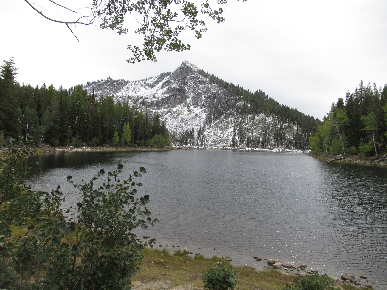
Payette Lake. Beyond that, the road was unpaved and rather rough. We stopped at East Fork trailhead (at about 5400 ft) just beyond the same-named campground. I thought that this was the trailhead for the Snowslide Lake Trail, but a couple of trail runners told us that the shorter trail to Snowslide was up the road a few miles. When we got there (at about 5900 ft), we found that the first obstacle was a stream fording. I found it not too challenging as there were rocks placed a reasonable distance apart. C.J. did mot agree that the distance looked reasonable. Plus the trail on the other side of the creek looked pretty snowy. We decided to continue on up the road as far as the 6900ft Lick Creek Summit. Naturally, the snow started coming down heavily as we pushed on. There were only a few places where it was sticking on the road so we continued to the top and then down another 1.5 mi to the Duck Lake and Hum Lake trailhead (about 5500 ft). It was still snowing as we geared up in waterproof jackets and boots and headed along the relatively gentle trail. The trail description must have been outdated because the few creeks we crossed all had bridges; no slippery logs or stones this time. It took longer than a half hour to hike the mile-and-some to the lake (5800) and the snow was 3-4 inches deep in places, but certainly did not require snowshoes. At times the snow was coming down in almost blizzard intensity, and then at the small lake we got a few minutes of clearing. Concern about the road conditions kept us from stopping for lunch as it started snowing again. We were back at the car in less time than it took to get up, and I scooped the snow off the cockpit covers (Yes, we were still toting around the kayak). We stopped alongside the road on the climb back to the summit during a lull so that we had a view while we ate lunch. Then we drove back to McCall where the afternoon showers were over and there was some sunshine. We took it easy for a while and then went over to the pool to use the hot tub which warmed us right up. We had had enough exercise already so we did not take the bikes out for a short ride. Wednesday is supposed to have the best weather of the week so we will ride or paddle or both then (hopefully). Meanwhile C.J. had taken the meat off the carcass and started a chicken soup in the crockpot we had brought along. I had gone over to the office to read the trail descriptions in the office copy of a guide published in 2000. C.J. roasted our beets from the garden with a carrot and we had some rotisserie chicken.

2 Oct, Wed – Ginny texted from Winnemucca that she and Wally were checking out and would be in McCall in time to take us out for dinner. It had snowed again overnight. The roads were still too warm to get any coverage but the car and kayak had an inch or so and the trees in the woods were liberally dusted with snow. It was cold and our plans to go riding were temporarily on hold again. We frittered away the morning with looking at maps and checking email, etc. The sun was out but it was still not going to get up over 47 deg today according to the forecast. Around noon or so we decided to at least drive out along the Goose Lake Road (paved, leading to the Brundage ski area) and see what the weather looked like by the time we got to the Goose Creek Falls trail. It was sunny and still cold when we got to the big snowmobile parking lot that is the trailhead for trail 354 before the winter sets in. The trail climbed a small ridge and then went down, down, down 720 ft to a bridge crossing
Goose Creek, The Falls were about ¼ mile south from the bridge. We ate lunch looking down at the tumbling water and enjoying the sun. Two young men were leaving as we arrived; a couple showed up as we were leaving so it must be a popular trail. It took about forty minutes to reach the bridge on the way in and about an hour to climb out. When we got back to the condo the sun was still shining and it was only 1530. C.J. checked with Ginny and they weren’t going to get to McCall until 1800, so there was time for us to go for a short ride. We took the bike path along Spring Mtn. Blvd to Lick Creek and then the short distance east until the path ended. We rode back to the condo and had a drink and some snacks. Ginny and Wally arrived around 1830 and we didn’t go out to eat until after 1930. The Cutwater in the Shore Lodge was casual but pretty upscale, with a view from ground level of the lake (until it got dark). C.J. ordered a Vietnamese sandwich with Kurubatu pork and I got the bison brisket sandwich with a real pile of tasty French fries. Later I signed up with Fed-Ex Delivery Manager and had the Laithwaite’s wine delivery sent to Safeway Fed-Ex on site. Two delivery attempts had already been made.

3 Oct, Thu – After a slow morning of breakfast and getting ready, slowly, we drove out to the
Ginny, C.J. and Wally at Louie Lake trailhead


trailhead for Boulder Lake and Louie Lake. Louie had sounded marginally more interesting so we took the two-mile trail that led there. First we had to cross Boulder Creek on an improvised bridge of several small tree trunks, then the trail led up through bushes and forest to a jeep trail that went all the way to the lake. [The jeep driver who tried to make it up the whole way would have needed some big, knobby tires, but it was clear from tracks in the snow that dirt bikes had used the trail recently.] It
Louie Lake and Jughandle Mountain
took an hour and fifteen minutes to reach the lake (1.8mi according to AirTribune and a gain of 7-800 ft) and the view across to snowy Jughandle Peak. We had lunch on the lakeside slope of the earthen dam before starting back down. I had fewer issues on the way down and we arrived at the car in about 45 minutes. On the way out we noted that the McCall Zipline operation might have people working or zipping today. Instead of returning directly to WM, we drove into Ponderosa State Park and took the scenic drive to Osprey Point where we had a great view of the Narrows of Payette Lake in the hazy sunshine. Back at the condo we all rested and had something to drink and eat. Around 1930 we had C.J.’s chicken soup for dinner with rye bread and fruit salad. Later we had some ice cream for dessert.

C.J. and "Sharlie" at Rotary Park
4 Oct, Fri – We woke up to snow falling around 0730 and it continued all morning. Wally and Ginny got going started for Montana after 0900, then stopped in McCall to replace a headlight bulb (complicated, because on the left side, the battery has to be removed to replace the bulb). I found out that the Central Idaho Museum is closed for the season and the Ice Rink has a curling bon spiel going on (“Rocktober”).  So we just hung around the condo until after 1500 when the rain quit and there were a few flashes of sun. We drove into town and walked west on SR55 (which has no sidewalks!) all the way to the bridge over the lake outlet, almost to the Shore Lodge. My goal was to get a couple of pictures of the full-size playground model of Sharlie the Payette Lake monster at Rotary Park. On the way we stopped at a couple of fabric/yarn shops; on the way back we went into the Manchester Ice Rink and watched a bit of curling practice, then crossed the street to visit a nifty-gifty store and look in at Chapala Mexican Restaurant. We got sprinkled on while walking back but not enough to get wet. Back at the condo we tried mixing some hot apple cider with vodka, and with tequila, and had some more chips. Dinner was a replay of the soup with a great big heirloom tomato cut up into it. We watched the snow coming down again. We hoped for a dry night and Saturday so we could go do something outdoors, but probably not kayak in the cold temperatures.

5 Oct, Sat – It was cold and cloudy when we got up and cooked some pancakes for breakfast. Around 1000 (?) we headed off to do some car touring since it was too cold and damp for biking and kayaking didn’t even bear thinking about. I drove south to Donnelly where we crossed a couple of bridges to get on the west side of the Payette River and Cascade Lake. Almost all the campgrounds (State Parks) were closed at the north end of the lake and only one USFS CG was open and a couple of State CGs down near the southern end. We drove up to Tamarack resort which appeared to be undergoing a major growth spurt with lots of construction. There are many bike, walking
C.J. at WorldMark, McCall

and xc-ski trails that a sign said are complimentary. We continued south on unpaved West Mountain Rd to the south end of the lake where there are a lot of cabins once you get out of the public lands. In the town of Cascade we stopped to see Kelly’s Whitewater Park and The Strand, a 2.5mi bike/walking path along the river. We headed north up SR55 to Farm-to-Market Road which took us to historic Roseberry. It was off-season so nothing was open but we drove around to look at the school and teacherage, the barn and Finnish church. We took Roseberry Road back to SR55 and returned to McCall where we got gas at Maverik again (2.859) – this time we wouldn’t have to turn back before we reached Warren. There was only a short delay on the Warren Wagon Road so we made good time on the paved road up over Secesh Summit (ca 6400 ft) and down to the Burgdorf Jct. Then it was all unpaved, wet, sometimes muddy, and snowy as we climbed up to Steamboat Summit. We got to our high point of 6600’ from our last trip and then descended a bit and went back up. The road was getting pretty slushy with snow in spots so we were somewhat concerned about going all the way to 6900’ as the guide book indicated. But it turned out that Steamboat Summit was only 6600’ also. The descent wasn’t too bad and we soon were close to Warren. We stopped first at a trail leading to the Chinese cemetery, sort of a misnomer since the bodies were all removed so that they
Warren Hotel and Assay Office
could be shipped back to China to be buried with their ancestors. From there we drove along big piles of spoil from the dredges that worked the valley for gold. Warren was every bit as old-looking as you would expect a place more than 100 years old. We drove through what is now only a small town and stopped at a one-room museum in the USFS Guard Station. Then we walked around the crumbling Assay office, the Warren Hotel, and the Baum Shelter (an operating bar and restaurant). Since it was snowing on and off (but also showing blue
 holes occasionally), we decided that we had seen enough and headed back up toward the summits before the road could get any snowier. On the way, we were passed by a long caravan of ATVs as we climbed (must have been 16 or more); I’m sure they thought we looked just as strange as they did with our kayak on top of the Kia and far from any lake. We got back to McCall shortly after 1700 and stopped at Albertsons to get som
e grapes on sale. Back at WM we got started packing for our return on Sunday. C.J. added cauliflower to the soup, and heated up the last piece of quiche for dinner – “mustgos” for the last night.

6 Oct, Sun – Sunny day but pretty chilly as the car and kayak were covered with frost. We got up around 0730 and were on the road before 1000 MDT. The frost on the ponderosa pines south of New Meadow was spectacular. Too bad there was so much low cloud/fog so that we could not see the
Part of WorldMark McCall
mountains. Later it cleared up and was sunny all the way home. We made several pit stops to use the rest rooms and get a little exercise. We filled up with gas at Idaho prices at a casino just outside of Lewiston (2.749) and then turned north staying on US95 rather than going though Lewiston and Clarkston on SR12. That took us up the Lewiston Grade; near the top we stopped at a viewpoint on the old (1919) switchback highway. Back on the road we diverted from 95 on 195 instead of going to Moscow (should go there someday). That put us on the Palouse Scenic Byway. At Colfax we turned west on SR26 and continued through the Palouse until it abruptly ended at the Adams County line, not far from Washtucna. In Othello we used Google to find an ice cream place called Ricas Fruetas and Ice Cream. It had the usual selection of ice cream but also paletas/popsicles, milkshakes, smoothies and other, more Hispanic items. C.J.’s strawberry-banana milk shake was good and my Java Chip blended coffee drink was also very good. The prices seemed very reasonable (9). No one appeared to be flying at Saddle; not surprising since the wind was from the SE. We finally ran into Sunday traffic just beyond Cle Elum on I-90. It was slow but moving and we got home right after 1800, following a stop to pick up our Fed-Ex wine delivery at Safeway (about 9 hrs, with the GPS estimating 7hr 47mn). Strangely enough, our mail for the week (I assume) was in our mailbox even though I had received confirmation of the mail hold I had requested. After dark, when it looked like it might rain overnight, we got the kayak down from the car and put it on the back deck under its cover.

31 October 2017

BOD San Jose and Bass Lake


18-30 October
C.J. hiking to Fresno Dome
18 Oct, Wed – We left in light rain and chilly temps around 0830. Gas in Covington (2.599). We didn’t run out of the wet until we were almost to Oregon. There was hardly any slowdown as we passed through Portland. We stopped at a couple of rest area and at a McDonalds in Woodland, WA, around 1130 to get me a mocha frappe since I was falling asleep. C.J. did some Google searching and found out that there was a frozen custard shop in Grants Pass. We stopped for gas in Roseburg (2.399) and then found Tommi’s in GP on 4th next to the RR tracks. They have six flavors

freshly made each day, plus coffee. There’s also the scrapings which go into their cheap shakes. I got one of those and Tommi threw in a scoop of coffee so I could try it – that was a lot of frozen custard. C.J. got a scoop of good pumpkin spice frozen custard. Then it was only another 25 miles or so to our hotel, The Ashland Hills, just off the freeway in eastern Ashland. We had dinner at the Luna Café which was quite good, soup and salad for me and a lamb pita with a Luna salad for C.J. Back at the room we caught up on stuff and talked to Chris A about where the profits, if any, from the Chelan events were going.

19 Oct, Thu – Breakfast was at 0700 so I got up at 0630 to shower. Breakfast was quite good; there were a couple of Belgian waffle makers and a vat of sausage patties as well as the usual cereals and oatmeal. There was also, lots of fresh fruit, hard boiled eggs and some mini cinnamon banana muffins. We were on the road before 0745. The fall colors were muted but colorful as we passed over the Siskiyous. A big cloud bank covered most of Shasta although the top and bottom were occasionally visible. Shasta Lake level was down a bit from the last time we saw it but nothing like the lows of past years. Some smoke was noticeable in the northern area of the state but it was not so hazy as we got farther to the south. When I wandered off the lane for the second time, we stopped for another McDuck’s mocha frappe in Willows. After that I didn’t really feel like I needed any lunch. We stopped for gas near Dunnigan at Pilot and got a 5-cent discount using our Good Sam membership card. Then we drove on all the way to San Jose. Strangely, our GPS sent us to the south of SJ to the Wyndham Resort. We had to backtrack up 101 to I-880 before reaching 1350 N 1st St and the Holiday Inn-Silicon Valley. We checked in around 1500 and went to the RRRG presentation by Mark Forbes. Around 1730 we walked a few blocks to Yamadaya, a ramen shop which had so-so ramen but good kar-age chicken. When we got back we went to the Bay Area flying weather presentation by Evan Cohen (and Honza via conference call).


20 Oct, Fri – Up early enough to both shower and get to breakfast. We didn’t think there was any reason to go to the Strategic Planning committee meeting (but it turned out that almost everyone was at that meeting as it was dealing with how to decrease the size of the USHPA board…maybe eventually to seven people). We had vouchers for 50% off the buffet breakfast. It was a really good buffet with made-to-order omelets, bacon, sausage, pastries, fresh fruit, hot chocolate with whipped cream, etc, etc. However, it turned out that we should have received a voucher for free breakfast as guests registering through the USHPA deal. We were able to pick them up at the front desk and the clerk said she would take the breakfast charge off our room tab. C.J. and I went to the Insurance-Finance Committee meeting chaired by Mark Forbes. He was pretty surprised to see so many people trying to fit inside the small room he had chosen. There was a lot of discussion but what we were there for was to find out about the requirement for insurance at an ACE (a non-comp event like a fly-in) event or the landowner would not be covered (even though the club had insured the site for the year. We found out that it was a new requirement based on RRRG rules (and it had
Jayne and Donnita Hall
not been the case that in prior years our landowners were not covered). C.J. had a lunch meeting/interview with Donnita Hall, the retiring Exec Dir of the FFF.  I had had enough food for lunch so just ate a Greek yogurt in the room while getting ready for my Awards Comm. Meeting at 1330. The only attendees were C.J., Jug and Mark F. We quickly chose recipients and changed the IOTY requirements by adding a requirement of a recommendation by a fellow instructor and/or instructor administrator.  We attended some other committee meetings (not too memorable, eh?). Around 1800 we gathered in the lobby and paired up people with cars with those needing a ride to the icebreaker. Jayne DePanfilis and David rode with us to Steins in Cupertino, a busy beerhall/pub. There was some snack-y food laid out on a long table and I got a flight of dark beers. Janneka (?) had name tags to match up for prize bags (My tag said Pot.ter and I found my match in a guy whose tag read “Hairy” and got me a led flashlight and a pair of fuzzy gloves, all item from Daiko Japanese 100 yen store). Later I got a seat at a table next to Russ Locke (still recovering from a paralyzing injury sustained in a crashlanding at Yosemite). And ordered a Stein Burger which C.J. and I shared. We got out of the noisy place around 2100 and the GPS worked fine to get us home to the Holiday Inn.

21 Oct, Sat – Up early enough to get the breakfast buffet again and still get to the USHPA membership meeting at 0800. At 0930 the BOD General Session began. It looked like the
Association’s finances are looking pretty good but our membership has dropped sharply to below 9000. I gave my report after a long report from the AIRS committee. Afterward I found out that I had lost a nomination somewhere for Bill Soderquist from Dan DeWeese. And Chris Santacroce and Paul Murdoch asked me about what we could do for Frank Gillette, the former Reg. 5 Director who recently died. I didn’t have a good solution if they wanted something awarded this spring. Mark gave us a ride to Goodies Ice Cream which had interesting flavors of handmade ice cream – perfect for a decadent, traditional lunch: two sundaes. Back at the general session, I asked the board to amend the awards comm. report by adding Bill Soderquist for a commendation and Frank for a FAI Hang Gliding Diploma. After finishing up the reports, Randy Leggett did a Q and A on the RRRG. The meeting ended early around 1730 and C.J. invited Calef Letourney, a new RD from Vermont to join us for dinner at the Smoking Pig on 4th Ave. He was a good conversationalist and we learned a lot about flying in Vermont (and nearby Quebec). He also has been running trips to Valle and only charges $1100 for 9 days incl. airport pickup, transportation and lodging. Dinner was BBQ pulled pork and brisket, beans, and a corn muffin which C.J. and I shared, plus a beer and cider. Back at the room I wrote in my journal while C.J. did another Spanish lesson.

C.J. at Ed Levin 300-ft Hill
22 Oct, Sun – We slept in a bit and then had another excellent buffet breakfast. I got the hotel to take the charge for the first breakfast off our bill. We checked out and set the GPS for Ed Levin County Park. It took us to somewhere in a light industrial zone nowhere near Ed Levin. Resetting to another option we followed directions to the actual location where Wally was teaching and paid our park entrance fee. C.J. got packed up and we walked across the LZ to the NW corner where Wally was picking up his “critters”. Aaron and Omi were waiting and we all rode up with Wally to the 300-ft hill launch. There were several other instructors (Jeff Greenbaum, Jesse Meyer) both hang and para. I volunteered to drive and made several trips up and down the hill to pick up the students and C.J. By around 1300 the wind had switched to more west and picked up and the lessons were ended. C.J. had gotten in two flights. We drove north on 680, and 580 then east on 140 through Tracy to Manteca where we stopped at Costco to buy a rotisserie chicken, a pineapple and a bag of oranges. We also filled up the gas tank (2.639) (good thing since the gas prices near Bass Lake were all over $3). The last hour of the 3.5 hr trip was on winding mountain roads east of Mariposa through a lot of burned forests. We stopped in Oakhurst to buy some groceries at Vons. The GPS took us right to the Worldmark at Bass Lake and we got checked in to our unit. C.J. made a salad and we had some of the chicken for dinner. I contacted Ron Jones, the site coordinator for the nearby (sort of) Tollhouse launch and got an invitation to come down and fly. It sounded like he would drive us up so Wally would not have to bring his big truck.


23 Oct, Mon – After breakfast we decided to go to the local ranger station to get info about local hikes. I thought we might do the Sierra Vista Scenic Byway so I just threw my hiking pack in the car and wore cotton clothes. The ranger station was closed so, after a quick look at the Mono Trail, we drove over the ridge to Oakhurst to go to the TI. We picked up a bunch of brochures and then decided to go to Glacier Point in Yosemite and maybe hike somewhere. On the way we stopped at the Sugar Pine Railroad, a tourist steam engine narrow gauge ride. There was quite a bit of recent fire damage (Railroad Fire) on the way to the park entrance. Once there we had to wait for 15-20 min for a one-lane construction area between the entrance and the (closed for restoration) Mariposa Grove. We drove past Wawona on Rte. 41 and continued to the turnoff to Glacier Point. There was a fire on the right side below the road but fortunately the wind was from the west and was blowing the smoke away. When we reached Sentinel Dome, the parking lot was full and we had to join other people who had parked alongside the road. After a short wait to use the single outhouse we started off on the 1.1 mile trail to the base of Sentinel. The trail then went around to the NE side and steeply up for another 0.1 mi to the summit. We had lunch on the granite slabs looking out at Half
Half Dome from the base of Sentinel Dome

Dome and the High Sierra peaks. Behind us was Yosemite Valley and Yos. Falls and El Capitan. There was a peak identifier on the summit and we were able to pick out all the mountains in the clear air. Having decided to do the whole 4.9-mile loop to Taft Point, we started down and then turned left descending through the woods to Sentinel Creek and Roosevelt Point where there was a different view of El Cap and the valley including the field in which we thought we had landed when we flew from Glacier Point on our hang gliders back in the 80’s. It was a long uphill walk to the next
C.J. at Taft Point, El Cap
intersection where we went right 0.5 mi to Taft Point, all downhill. Taft had several deep (2000’!) fissures, one with chockstones. At the edge was a small metal railing and then a dropoff that seemed to go all the way to the floor of Yosemite Valley. It was dizzying. We started back up to the parking lot around 1630 and made it up the mile by 1700. It seemed a bit faster returning south on 41 and we would have reached WM by 1830 but once we got back in cell phone range we heard from Ginny and Wally who were planning to stop in Oakhurst for pizza. We met them at Raleys Grocery and then went to Me’n’Eds for dinner. It must have been close to 2100 when we got back to the resort and C.J. and I certainly felt ready for a shower.

24 Oct, Tue – Ginny made a scramble for breakfast and there was special bacon, orange juice and C.J.’s pumpkin spice cream cheese muffins. Ginny had some work to do so we didn’t get started on our hike until after noon. Then we drove the short distance to the Willow Creek trail head on the upper road around Bass Lake. We got on the trail about 1300 and almost immediately lost the trail since we figured that it would be along the creek. Instead the trail climbed steeply up a rocky slope while we bushwhacked along the south bank of the stream. Eventually we crossed over to the other side and found a trail there while I mostly walked on the granite slabs on the side of the stream. We reached Angel Falls and had lunch in the shade. There was a large diameter pipe that started above the falls – probably the water source for the community of Bass Lake. [There was a building at the trailhead noted on the map as the Bass Lake Chlorinator.] We continued upstream on the left side and finally climbed up far enough to hit a fire road. A quarter of a mile up the road (or less) we took the right fork to get back to the creek. It was a good place for Ginny and C.J. to soak their feet. A hiker showed up coming along the right bank of the creek, crossed where we were and told us that the main trail was along the south bank. So, when we started back down we followed the well-trod path on the south. We were out of the woods by 1545 having covered 2.5-3 mi. We took the scenic route back going on the lower road through the town of Bass Lake – not much to see except a lakeshore crowded with mansions and one day-use park (USFS?). Back at the condo C.J. and I went over to the pool and hot tub. The pool was much warmer than the creek, but enough to cool us off. Later C.J. made chicken with pesto and served it over angel hair pasta along with a spinach and fruit salad. Ginny gave C.J. an assortment of lotion and creams for her birthday and served an assortment of cheese cake slices for a birthday cake. Later I signed waivers  online and paid our day-use fee to the Central California HP Club online.

25 Oct, Wed – Wally and Ginny went out to breakfast at the Pines (Ducey’s) while we had our usual. Since they had decided to walk, they weren’t back until after 1130. Around 1150, Ron called to say he’d like us to get to the LZ around 1330. We managed to get everyone out the door by 1215 and took the KIA. Ginny had decided that her time was not best spent in long drives and waiting around while we flew so she stayed behind. [Later she drove down the west side of the lake through North Fork and then down to the San Joaquin River Gorge where she had a good walk along the river and returned home just as we arrived back at WM.] Our route took us through North Fork and across the gorge of the San Joaquin River, then up through Auberry (spelled “Au-beary” on their sign perhaps in honor of all the carved bears in the small town) and on to Tollhouse. We were a bit early so had time to get our boots on and gear arranged before Ron arrived promptly at 1330. He took us across the street from the cemetery parking lot to the huge LZ and pointed out where the launch was and how people usually flew the site. Then we loaded our gear onto the back rack of his old Jeep and we headed up the many switchbacks of the old toll road to the summit. There we turned SE onto Burroughs Mountain Road, a rough, 4WD track, and went a couple miles to the launch. It was an excellent launch with shade for set up and a clear, mowed grassy area for takeoff. We got more information about possible house thermals and cross-country routes. I launched at 1600 and immediately climbed above launch, but not too far. I was out of shape with respect to thermal turbulence, so I didn’t get much higher than a bit over the top of the mountain (4200). Wally and C.J. seemed to get somewhat higher but not the thousands of feet above that we thought might be possible. After working the area around launch for a while, I started off to the NW and found quite a bit of sink. It wasn’t until I got almost across to a ridge extending down from where Rte. 168 (“the four-lane”) crossed the Burroughs ridge that I found a nice mellow thermal and was able to core it back up over 4000. Meanwhile Wally had gone out to the LZ and landed. I faded back toward where the old toll road zig-zagged up the mountain below “Squaw Tit”, now called “the bump” or something else innocuous. I was careful to avoid the area to the right which was a deep canyon often with a lot of sink and a headwind when trying to get out. I didn’t find much over the ridge below the four-lane and had to head toward the LZ. I made a wide circle before coming in to land into the light breeze. (0:44) C.J. followed a similar route and landed sometime after me. Ron was already in the LZ to greet us and make sure we got down safely. We packed up and got going around 1730 and retraced our route back to WM Bass Lake arriving around 1835. Wally and Ginny took us out to dinner at Ducey’s, an upscale restaurant in The Pines Resort. The soup, salad, lamb shank, duck breast and my petite filet mignon were all excellent.

26 Oct, Thu – Wally and Ginny were leaving today so we had only the morning to do something. We drove over to the west side of the lake and walked the Trail of the Mono which had information about the Native Americans who lived here before the Europeans arrived. The trail led past a granite outcrop which had depressions that had been ground out by stone pestles for grinding of acorns to flour, the basic food of the Mono people. When we returned to the KIA, we continued south along the lake past Millers Landing Resort and the rock and earthen dam to North Fork.  We checked out the USFS ranger station which was really nice and had lots of things to buy as well as some free Smokey Bear stuff. Then we spent an hour at the Sierra Mono Indian Museum and had a really good docent explain some of the intricacies about the basketmaking and the materials used (like deer grass and bark of the redbud tree). We got back to the condo around noon and Wally and Ginny got packed up and out sometime after 1300. We ate some chips and hummus for lunch and then headed off to have some ice cream at Reimers in Oakhurst. We also browsed through the outdoor sports and souvenir shop next door, Sierra Nevaqda Trading Post. Thinking that might go for a drive up the Sky Ranch Road past the (closed due to cleanup from the Railroad Fire) Nelder (Giant Sequoia) Grove, we stopped at the TI and checked to see if the road was open as far as the Beasore Road so we could make a loop of it. The head counsellor said that it was but that the road was very rough. We went anyway and the pavement did stop near the entrance (2 miles down the road) to the Nelder Grove but it wasn’t all that bad – certainly nothing like the Burroughs Mtn Rd. We stopped at a somewhat obscured view of Fresno Dome, then farther up the road there was a better view. Finally we took a left fork leading to Fresno Dome CG (also closed) and got a really good view of the granite dome (7540’). Backtracking to the Sierra Vista Scenic Byway which we had been following we continued up and over a 7300’ high point and then down another mile (for a total of 20 mi) to the paved Beasore Road. There was a rest area and a 700’ trail to Cold Springs Meadow there. So, we took a break before heading back down the very wind-y road to Bass Lake and our condo at Worldmark (around 1730). We’re down to 5/8 of a tank so we’ll pick up gas in North Fork before doing the rest of the SVSB on Friday. For dinner we had the leftover lamb shank, leftover potatoes from the Newhall’s weekend, and a fresh salad.

27 Oct, Fri – After breakfast we took our hiking gear and drove into North Fork to get gas at Vons (3.299) so that there would be no chance of running low while we were out in the boonies. We stopped at the ranger station to ask about identifying the trees with reddish, deeply-fissured bark, and flattened cedar-like foliage, but they were “busy” so we looked in a guidebook then left. Our plan was to do the whole 100 miles of the Sierra Vista National Scenic Byway. The weather was cooperative – it was another beautiful fall day, if a bit warm, especially in the sunshine. We skipped the chance to see the geographical center of CA a few miles SE of North Fork down Italian Bar Road near Redinger Lake, but we did stop at an overlook to look down at Redinger and the San Joaquin River Gorge. The cycles were blowing up on what looked like a perfect launch (no place to land, of course, but the TO looked great). We stopped several miles farther up the road at a junction with a road that went down to the river and a powerhouse. I got the binoculars and spotting scope out so we could see the many penstocks and waterfalls. Next, we stopped at the Jesse Ross log cabin. It was built in the 1800’s using continental methods so, the logs were all hewed square in x-section. The inner walls were covered with vertical boards and then those were covered with newspaper or wallpaper. We reached about 5300 ft at the Mile High Vista where we ate lunch while looking down at Mammoth Pool, a reservoir which was much lower than usual, and out at the Sierra Crest (Mt Ritter, Minarets, Mammoth, et al.). In the middle distance were several granite domes, Balloon Dome and Fuller Rock. About 20 minutes beyond the turnoff for Mammoth Pool, we stopped at Arch Rock, a small, granite erosion arch. Shortly afterward we ran out of pavement and the road got rough. Thinking that we might do a hike, we drove the 1.5 mi in to Piyau Dome Trailhead. The trail was indistinct, we didn’t know the length or elevation gain of the trail, and it was already 1400 so we drove back to the road. We stopped to walk a short path out to Jackass Meadow, and again at Portugese Overlook to look up at the big granite domes above the road. All along the route we had seen trailers and tents in dispersed camping areas, but we didn’t see any people around, hunters maybe? One of the hits of the trip was the stop at Globe Rock which was a huge granite boulder sitting on a pedestal, appearing to be delicately balanced. The road was paved the rest of the way from Globe Rock. We closed the loop (from yesterday) at Cold Springs Summit and then headed down and down the rest of the way to the upper road at Bass Lake and home to Worldmark. Snacks ensued and then dinner – a casserole with the original rotisserie chicken cooked with onion, corn and beans. Later I paid the remainder of our trip balance online to OAT for the Machu Picchu and Galapagos trip. I also researched the hiking trail to Fresno Dome and found it was only 1.5 mi with an elevation gain of 311 ft. Sounds like a plan for Saturday.

28 Oct. Sat – Up at just after 0700 and out on the road by shortly after 0900. We re-traced our Thursday drive up Sky Ranch Road and then along FS 10 to Fresno Dome CG and another couple of miles to the unexpected and impressively-signed trailhead for Fresno Dome. No one else was parked there and a pickup pulled out through a puddle of indeterminate depth just as we arrived. Knowing that there was a solid bottom to the puddle we pulled in and parked near the start of the trail. It was nice and cool so we could wear long sleeve shirts all the way to the summit, about 1.5 mi and 350 ft elev gain, at 7540 ft. The trail through the pines was well-trodden and pines themselves were aglow with bright green lichen as the sun struck them. The back of the granite dome was easy to ascend since it was much less steep than the south face which is where the climbers go (although we never found a climbers path leading from the road). After we had enjoyed the summit for a half-hour or so, more people started to arrive. The first party of six from Montana knew two old hang glider pilots that we also knew: Steve Aden and Ron Enck, a real coincidence. Another party of four and a couple more followed them up as we started back down. I had used my spotting scope with the very light tripod I usually carry for my camera, and it wasn’t very stable. But, I could look out into the valley and also off to the NW to a fire tower on a high ridge. At the parking lot I considered continuing around to the Sierra Vista National Scenic Byway on FS 10, but we wanted to stop in Oakhurst so we returned the way we had come. There were quite a few vehicles on the road now that it was the weekend and we saw some of the people in the dispersed camps as we went by (unlike the previous day when we saw almost no one). Also on the way in we saw our first large mammals when three deer crossed the road ahead of us. One of the people we met on the trail told us that this weekend was the end of the hunting season (but I might have gotten that wrong). In Oakhurst we stopped at the Sierra Nevada Trading Post and C.J. got a Yosemite coloring book and a black bear coaster. Then we hit Reimers again and C.J. got a scoop of pomegranate blueberry gelato and I got a coffee-chocolate shake. We headed right back to Worldmark and were there in time for the annual party thrown by the management for the staff and guests. We got free burritos from the Sonora Taco Truck, a drink and plenty of fruit and desserts. The kids were having a good time in the inflatable bouncy house and later when they smashed a large piñata filled with candy. We got caught up on our journals and started to organize stuff for packing up later when we could move the car nearer to the condo unit. Once I got the car under the parking area covered with solar panels, we loaded our wings and some miscellaneous stuff. We had dinner, salad and the left over burritos, around 1900. After that we watched “Sully”, a film about Chesley Sullenberger; much of it was about the NTRB investigation of the water landing in the Hudson in January of 2009.

29 Oct, Sun – Up at 0630 and on the road shortly after 0800. Another beautiful day. We drove through the foothills on 47 and 120, followed freeway 99 through the flatlands of the San Joaquin Valley and continued north to Sacramento where we got gas at Costco (2.499). We hooked up with I-5 and soon enough we were at Dunnigan and back on our usual route. We stopped again in Redding to get a Costco frozen mocha for me and after that I was much more alert, but that may have been because we were leaving the Sacramento Valley and heading up into the hills leading to Shasta. Great views of an almost-bare Shasta in the clear air although we could see occasional tendrils of smoke in the valley to the west. We reached Ashland right around 1700 and checked into The Ashland Hills for the night. After asking at the desk and looking at Yelp, we decided to eat at the Luna Café again. I even had the same chili and Caesar salad while C.J. had the Special, a Chef’s Burger, with a bowl of seasonal vegetables. We shared a pear cider.
30 Oct, Mon – Got an early enough start that we didn’t run into any traffic slowdowns even in the usual places like Portland and near Olympia. We stopped for gas in Roseburg and Covington. I was supposed to be on a low-fiber diet in prep for the colonoscopy on Wednesday. We got home around 1630, early enough to pick up our mail at the post office. There were lots of leaves covering the lawn and driveway, nice and dry, but there were still more remaining on the trees. The house seemed cold, but that may have been due to having been in sunny California for so long. Apparently we missed some serious rainy weather while we were gone. It was going to be hard to adjust to the normal rainy-cold Northwest autumn.

30 May 2015

Glacier National Park

 Late Spring 2015


Some of our RCI points were expiring during June. If we wanted to get some use out of the points generated by the Verde Ridge property, we would have to use them before the end of the month. We had already discussed a trip to Glacier this summer but this seemed like a possibility. Checking with RCI online we found that there actually was an RCI resort near West Glacier so we signed up for a week. After the fact, I checked with GNP and found that they were still working on clearing the Going-to-the-Sun Highway and the earliest that it would be open was mid-June. Uh-oh. Hopefully there would be things to do that would not require a trip across the park! At that point we didn’t know if we should bring snowshoes and skis or hiking gear. It wasn’t until we were almost ready to leave that GNP posted a video on Facebook showing a drive along the road to Many Glacier and there was no snow except on the high peaks. Okay, so we would take boots and trekking poles…and our sea kayak. There were some long, narrow, fjord-like lakes on the west side of the park that might be fun to paddle.

22 May, Fri – We got up earlier than usual in order to get on the road around 0700 for the 500 mile drive to West Glacier. My rule of thumb is that we average 50 mph on every long trip so it would take ten hours, putting us in at 1700 for check-in. We didn’t get going until 0720 and then realized that C.J. was lacking a rain jacket and pants. With a little use of mobile data we figured out that we could hit the REI in Spokane and take advantage of its spring sale for some new rain gear. C.J. also found a new, lightweight daypack on sale. Next we stopped in Coeur d’Alene for gas at Costco ($2.499, much cheaper than the
Glacier Wilderness Resort cabin
$2.839 at the Iss. Costco). In addition to those two stops, we had to undergo two boat inspections – one in Idaho and one in Montana [Plus there was a self-certification process for the kayak at GNP, as well.] All those delays put us close to 1830 by the time we pulled into Glacier Wilderness Resort. New owner/manager (?) Christy checked us in and then sent us on a short hike to see the waterfall just a few hundred yards upstream. We paid for our cleaning fee ($25) and for wifi ($15) which is only on during the day. Back at our nicely appointed two bedroom log cabin, C.J. whipped up a pasta, ham and pesto dinner.

23 May, Sat of Memorial Day weekend – Up around 0700 and out by 0850, we drove the eight-plus miles to the West Glacier/Apgar entrance to GNP. Our plan was to do the Avalanche Lake hike, an
C.J., Avalanche L Tr.
easy five-mile round trip with only 500 ft of elevation gain. We drove the fifteen miles or so along Lake McDonald and McDonald Creek to the trailhead…and the end of the Going-to-the-Sun highway. We weren’t prepared for the crowd of bikers who filled the parking lots on both sides of the road. They were going to bike up the now-cleared road as far as Logan Pass; some were carrying skis, intending to climb up to some good spring-skiing. There were plenty of hikers as well for the Avalanche Lake Trail, not quite a steady stream but we were rarely out of sight of one group or another. The first 0.4 mi were on the boardwalks or pavement of the Trail of the Cedars nature trail, then we started climbing alongside the gorge of Avalanche Creek. The trail was mostly in the forest but at one point a large landslide from a mountainside to the north had smashed through the trees and opened up a view.
Results of avalanche
When we reached the lake the views were excellent, but the crowd of people lounging around the outlet end of the lake detracted somewhat from the wilderness ambiance. After taking a few photos, we continued around the lake to the far end, about 0.5 mi. There we found a log on the beach near one of the inlets, a good place for a scenic lunch break without the crowds (and without the plague of chipmunks) at the other end of the lake. After some crackers and cheese and a cookie, we headed back along the same trail. There were, if anything, more people on the trail than there were at ten or eleven o’clock. Back at the trailhead C.J. and I walked the rest of the nature trail which had some interpretive signage done as haiku on watercolors. On the drive back to West Glacier we stopped several times along the cascading McDonald Creek to walk to various viewpoints (once, a footbridge) for pictures. Then we skipped McDonald Lodge to go to Apgar Village where we found an ice cream shop ($6.25) and checked in at the Visitor Center to get info about kayaking – the ranger thought Bowman was just as good as the farther-in Kintla Lake, and that the p.m. wind was down lake (from the NE) (unlike what we observed around lunchtime at Avalanche Lake). We stopped for gas in West Glacier (2.599) and then drove back to the resort. The wifi was working and C.J. was able to check the weather; I downloaded email. Later C.J. roasted a big chicken, baked a potato and prepared some veggies for dinner.

24 May, Sun – Saturday night we had agreed to hike to the Apgar Lookout not far from the west entrance. The guidebook said that the sun would be in our eyes looking toward the scenery east of
C.J., Tr to Apgar Lookout
McDonald Lake, so suggested the climb be made later. That didn’t seem like a good idea considering the fact that the whole trail was located in the 2003 Roberts Fire and there was little shade to be had. We got away from the resort by 0915 and started up the trail at 0945. Unlike the day before, this time we had an elevation gain of 1800 ft in 3.2 miles. The first mile or so of the trail climbed along Rubideux Creek through young lodgepole pines no more than 4-5 ft tall, plus some low alder liberally festooned with tent caterpillars. Once we reached the first long switchback the slide alder appeared to have been sprayed as all the leaves were dead. Three switchbacks crossed the entire face of Apgar and made for a relatively gentle but unrelenting climb. Although there had been only five cars in the small parking lot at the trailhead, we were passed by several parties both ascending and descending. We made it to the fire tower just before 1245 and the view north to the snowy mountains along the continental divide was excellent. We climbed to the small wrap-around deck of the tower for the view, somewhat obscured by the broadcast TV tower and the trees, then returned to the ground to find a place to eat with a reasonable view. Others arriving after us settled on the deck to eat. We continued to meet people who were on their way up as we descended although that couldn’t have been pleasant as the temperature had increased, particularly in the sun. Later the clouds grew enough to provide some shade. I had not carried enough water and sucked my Platypus dry before we reached the only water near the trail, not far from the trailhead. Once back at the now almost full parking lot we headed for West Glacier where I thought I could get a good mobile phone signal and contact Consumer Cellular [I have not been able to receive calls for at least the last two days]. We parked at the West Glacier Mercantile but there was one bar or none for cell reception. We looked to see what was available in the Mercantile – not much, and all priced for low supply, high demand. Back at the resort around 1600 we showered and then tried some of the Blue Moon varieties we had brought with us, along with some chips and onion dip. C.J. threw a bunch of sweaty clothes in the washer so we could start fresh on Monday (although the weather is sounding less promising with rain or thunderstorms in all the forecasts).

25 May, Mon, Memorial Day – Another beautiful morning so we got packed up and out by 0900 heading east on US 2 for the other side of the Park. We stopped at Essex to drive up the hill to see the Izaak Walton Inn, thinking that we might stop there for dinner someday. Just a short way down Rte 2 we stopped at the Goat Lick Observatory even though the parking lot entrance was gated. No goats were licking so we rolled on through increasingly magnificent scenery. We stopped again at the summit of Marias Pass where there was a replica of the Washington Monument dedicated to Theodore Roosevelt. Heading down the other side we came to East Glacier Park and turned north to get to the entrance to the Two Medicine area of Glacier. We stopped to check conditions at the small Ranger Station and then drove to the boat launch. The lake looked calm and the sky had only a few clouds so we quickly set up the kayak and paddled off. We headed for an obvious point on the south shore, and when we got close C.J. spotted two moose – a cow with a very young calf. We got some good photos as we drifted by them. We reached the west end of the lake in about 45 minutes and caught up with another kayaker who had left just before us but had missed the two moose. C.J. and I pulled our kayak up in front of the Adirondack-style shelter near the boat dock and changed shoes for a walk up
the trail about a mile to Twin Falls. I felt kind of naked without my pack and trekking poles, but I did have the bear spray
Young Moose at end of Two Med. Lake
(which we have carried on all our hikes). Meanwhile the weather was changing and we heard a couple of rumbles of thunder. There were a few other folks on the trail who had hiked along one side or the other of the lake and most were stopping at Twin Falls and then continuing another 1.3 mi to Upper Two Med Lake. Just as we got back to the shelter, two young moose appeared across the stream from us. They were too busy stripping the leaves from the willows to care that we were taking their pictures, and then watching them as we ate lunch. Eventually they moved off along the trail to Twin Falls, and we re-launched the kayak and headed downlake with some wind in our faces. Still it took us only 45 minutes again to reach the boat launch at Two Med. We got some help lifting the kayak back onto the car then we drove over to the campground to see what the sites looked like; they were all pull-through, very
Mtn Sheep in Two Med. Campground
convenient for our small trailer, and some had great views of the mountains. Best of all we encountered a small herd of mountain sheep wandering through the campground, some even eating whatever was left in a firepit. We made one more stop to hike 0.3 mi to Running Eagle Falls (once known as Trick Falls) which has an upper stream flowing over the top of the falls and a lower stream coming out of a large cave. As we left Two Med it started to rain and it rained pretty hard until we were out of East Glacier and back on US 2. At Marias Pass we stopped to drive through the USFS Summit CG – all sites suitable for small trailers, $10/night, about 5200 ft. It was really too early to stop for dinner at Izaak Walton (1700) so we returned to the resort for some drinks and snacks before a meal of homemade chicken soup. We discussed plans for the next day and decided on going to the North Fork area of Glacier and paddle Bowman Lake. We thought a dawn start would give us the best chance to see critters (but then we found out that we would have to leave at 0400 to get to the launch by 0544, dawn. We’ll see if we can get going so early.

26 May, Tue – We woke, as planned, at 0400 and were on the road before 0500. The Camas Road was paved all the way from Apgar to the North Fork Road (outside). Surprisingly, about half of the
Bowman Lake campground and boat launch
North Fork was paved, too; maybe it was just the part through privately-owned land. At Polebridge, the tiny community that is home to the Polebridge Mercantile and Bakery, the road became not only unpaved but narrow and much rougher. [A sign at the barebones NPS ranger station at Polebridge explained that the road condition was kept that way on purpose to keep the area as wilderness-y as possible.] We had no trouble with the six miles of the Bowman Lake Road but we also felt no need to exceed the posted 20 mph speed limit. It was about 0615 when we reached the campground and boat launch, about 30 minutes after sunrise. The lake was still calm; the air wasn’t too cold but the water was frigid. I switched my lightweight pants for some fleece and added a layer of fleece under my PFD. The surrounding mountains were shrouded in fog and clouds and we could see none of the snow-frosted mountains that would appear later as the
By 0845 the clouds had lifted
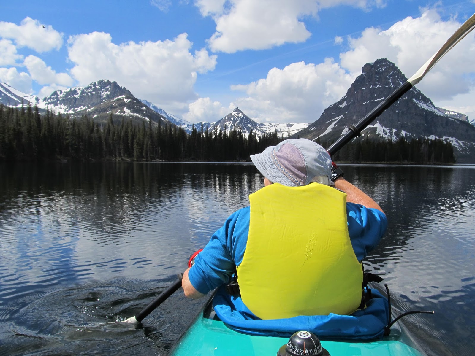
clouds broke and the fog burned off. It was probably 0700 by the time we were on the water and paddling up the north side of the lake. There was one other boat on the water and a few people in the campground, nothing like the more-accessible Two Medicine. We stopped for a break after an hour (and about three miles of paddling) then continued to the end of the lake (a bit more than six miles as the crow flies) and backtracked to the backpackers’ campground. We rested for a while and had a snack then headed across the lake and down the south side. C.J. said her feet got so cold while getting into the boat that they didn’t warm up for an hour. Eventually the sun broke through and by the time we were making the last crossing back to the boat launch, we were wishing we had removed at least one layer of fleece. Back on land around noon; after unloading the boat we had some lunch in the sunshine and then hit the road for home. We stopped at the Polebridge Mercantile to get one of their famous pastries ($4.75), and thought we might go to Columbia Falls to replenish our fresh veggie and fruit supply. When we reached the Camas Road, though, we stopped to walk the
Great reflections on a calm lake
Huckleberry Nature Trail which was mostly about the 2001 Moose Fire (although there were no informational booklets to go with the numbered signs on the somewhat long and up-and-down trail). We stopped for a few more roadside exhibits, then C.J. noticed that she had four bars on her phone. Since I needed to cancel my June 1 VA dermatology appointment, we stopped alongside the road and I dealt with that. Next I called Consumer Cellular because my phone was not able to make or receive calls. We got both things straightened out but in both cases there were long waits for a customer service agent. By the time I was finished we were both ready to head directly back to the resort and crash with a cold drink and some snacks. On the way back I stopped to fill up the gas tank (still $2.599) at Conoco in case we might be heading across Marias Pass on Wed. Around 1800 it rained hard for several minutes – glad we weren’t out on the lake or on a trail.

27 May, Wed – Thinking that we would be tired and sore from 12 miles of paddling, we planned a very low-effort day. We got up sort of late, had bacon and eggs for breakfast and then did computer
Hungry Horse Dam through burned trees
stuff until around 1100. I had been checking on the Museum of the Plains Indian at Browning on the east side and thought we might go there and maybe up to St. Mary or Many Glacier if the weather looked good. Radar showed rain squalls sweeping through Browning so we headed instead for Hungry Horse Dam just a few miles west of the park entrance. [On the way we stopped at the Glacier National Park Conservancy housed in the old train station in West Glacier. We found a neat Christmas decoration made of a red, metallic cottonwood leaf with a bear design ($17).] The dam was moderately interesting even though the visitor center was closed for staff training. We walked across the dam to an informational sign and the huge gantry crane, then drove into Hungry Horse where we found a helpful person in the big Forest Service ranger station. She pointed out some places to hike and kayak around the 30-mile long reservoir. We went back to the dam and a couple of miles along the reservoir road to FS 895H which took us up a rough road toward Doris Ridge where there was supposed to be a trail. We didn’t get that far but stopped for lunch three miles up the road where we had a good view of part of the reservoir and the peaks of the Great Bear Wilderness which separates Hungry Horse Res. from Glacier NP. Afterward we continued up the road another five miles until we spotted a lake on the car GPS, and a trail on the side of the road. Later we found out that the lake was either Alpha or Beta [Google Earth shows that it was Beta.] and was only a few hundred feet from the road. Since we had already put on our boots and slung our packs, we decided to follow a herd path around the lake. It was easy going at first with the trees that had fallen across the trail chain-sawed to provide access. By the time we reached the end of the lake, however, the trail had petered out. We clambered over fallen trees, walked carefully across patches of snow and fought our way through tangles of slide alder (or willow?). Eventually we found traces of the trail again as we neared the place we had started. Back at the car we descended the eight miles to Reservoir Road then drove back into Hungry Horse intending to continue on to Columbia Falls to get some groceries. But we saw that there was a Family Grocery in Hungry Horse and their reader board was showing some good sale prices so we stopped there ($13.13). If this small town had such good deals, maybe Montana wouldn’t be such an expensive place to live (both gas and food have been cheaper than back in Washington). On the way through Hungry Horse when we had first arrived several days ago we had seen a tourist trap called the Huckleberry Patch and now we had time to check it out. We got some ice cream ($6) and looked at all the things made with huckleberries that were for sale – fudge, honey, hand cream, pies, tarts, etc. – plus the usual t-shirts, hats, plaques and stuff that visitors buy. As we headed home, we ran into heavy rain but it let up before we got to the resort. Todd met us at our cabin and let us know that power was off (except in the lodge which has its own generator). He also told us that guests for the past two weeks had seen bears, sheep, goats and more in the Many Glacier area, so that may be where we are headed on Thursday depending on weather. I picked up a bundle of wood (usually $5, but free when power is out) in case it got cold. We ran our computers (no Wi-Fi, of course) until our batteries were down to almost nothing. And then around 2000 the power came back on and C.J. could prepare dinner on the electric range. We had a fire anyway while we ate dinner.

28 May, Thu – C.J. woke up pretty early so we got a reasonably quick start even though the weather
C.J., Tr to Apikuni Falls
did not not look too promising. Unlike almost every other day during our week here, the sky was overcast in the morning. We drove straight through to Many Glacier stopping only for a few minutes at a pile of rocks north of Two Med  where two marmots provided our first critter sighting of the day. We got to the St. Mary GNP visitor center just as a bus load of fourth graders arrived for a field trip. By now it was starting to rain lightly. We asked a ranger there about where the best bet would be for seeing wildlife, especially bears. He told us that Many Glacier had a reputation as a place to see moose and bears. He also suggested a short walk to Fishercap Lake, about five minutes up the Swiftcurrent Pass trail. When we got to the trailhead it was raining pretty hard so we sat in the car for
a while donning our rain pants and jackets. By the time we got out the rain had slackened to a persistent drizzle/light rain. It really was only five minutes to the little lake although the trail sign indicated 0.7 mi (or maybe it was km). No moose and
Apikuni Falls, Many Glacier
definitely no bears. We decided to go with our backup plan and hike to Apikuni Falls, about a mile and a gain of 700 ft. We met a few other people on this trail but at least it never rained hard. The falls were high and had a lot of volume. Still no wildlife, but there were some wildflowers. It looked like we were going to be skunked since our next stop was the Plains Indian Museum in Browning far from the wilderness. However, just before the entrance station we spotted a big bear cross the road. It spent some time feeding on some roadside plants, and then a baby cub appeared. Wow! Mama Bear didn’t return to the cub even when it disappeared back into the woods. Moments later we could see the black cub climbing a cottonwood and another cub, this one brown, racing him up to a high crotch in the tree. Staying in the car (unlike some clueless tourists behind us) we tried to get photos through the thick foliage. Whether our pictures came out good or not, we were really excited to have finally, on our last day in the Park, seen not one but three bears. After that even the best museum was going to be a disappointment, but the Plains Indian Museum turned out to be really well done, and the price was right - free until June. We drove directly back to the resort from Browning and got in around 1700. The weather was sunny around the resort so we loaded up our kayak and as much other stuff that we would not need so there would be less to pack in the morning.

29 May, Fri – Got started around 0840 then had to turn back to find the radio antenna that had rolled off the roof (I unscrewed it from its mount before loading the kayak.) It was on the highway and hadn’t been run over too many times. After getting gas at Conoco (still the same $2.599) we took the slow route from West Glacier through Columbia Falls and then down through Kalispell. Other than that, we used the same route that we used to get to Glacier last Friday. We stopped near Paradise at a fishing access site to use the outhouse, stopped briefly for the Idaho watercraft inspection, and got gas again in Coeur d’Alene at Costco (price now $2.579). We made one more stop for an ice cream at Red Door Café in Moses Lake which we found by using Siri, Google, and Yelp (although they all were out of date, calling the café Firefly Ice Cream Parlor) ($4.87). We got home around 1800 with the fatigue of a busy seven days catching up with us.