17 May - 3 June
Once again the wet and cold of May in the NW convinced us to throw our camping gear in the car and head for warmer climes. We optimistically packed our paragliders as well, hoping to fly at Mingus Mountain, at least, and maybe at the Craters near Flagstaff. Another factor affecting our decision to travel even when gas prices were so high was that we were about to lose our 2009 timeshare points. To make good use of them we booked several days at Pine Top in the White Mountains of Northern Arizona and the two days just before the holiday weekend at Flagstaff. [We also booked a week at Estes Park, but that is for September.]
17 May, Tues - Still wearing layers of fleece we got an early (for us) start at 0900 and drove in sunny weather through Yakima River Canyon (where the river was high). We stopped for gas in Union Gap and Nampa-Caldwell, browsed the offerings at Sierra Trading Post and drove on to Glenns Ferry trying to decide if it was too rainy to camp. But Three Mile Island State Park was dry and the sky looked reasonable so we pitched the tent on the grass. [Oh, yeah, no trailer this trip - the weather should be fine for camping and we've got a week of condo living in the middle.]

As soon as we settled in, it started to sprinkle and the wind picked up. We set up our little folding tables under a nice dense tree and managed to get dinner cooked and stay dry. Later the sky cleared and we took a walk around the park. The large Oregon Trail Interp. Ctr was closed but there was an old winch-operated ferry on the riverbank and a couple of emigrant wagons on display.

The park also has small cabins for rent, but they're probably not that great a deal compared to the half-price camping ($11.66) for seniors on Mon-Thu.
18 May, Wed - It was still windy enough in the morning to blow the tent into the next campsite when we turned it upside down to dry the floor. But the rain did not begin until we were down the road a ways. There was fresh snow on the Sweetzer Pass (5300') hills and it rained on and off through Utah. We picked up gas, a Costco lunch and some AAA maps and guidebooks in Ogden. Then we stopped again in Orem/Provo at another AAA office because our plans to drive to Capitol Reef seemed to be rained out and maybe Death Valley might be a better option. At a Barnes and Noble we used the free wi-fi to make a Motel6 reservation in Cedar City. The farther we drove, the worse the weather until we were driving in mixed snow and rain as we entered Cedar City. We were glad to have a solid roof and an adjustable thermostat for the night.
19 May, Thu - There was new snow on the hills in Cedar City but at least it wasn't precipitating as we headed down the road past the Kolob section of Zion NP. The weather looked better ahead as we gassed up at St. George Costco and grabbed info on LV, NV and Death Valley from AAA. We continued down I-15 through the Virgin River gorge and then took the scenic route through

Lake Mead Nat Rec Area
(photo, left), stopping for lunch at Echo Bay. We ate just outside a campground on a bluff overlooking a narrow valley that must have been a lake inlet before drought and increased usage lowered the lake level a bunch (something like 120 ft).
Later we stopped at a trailhead and climbed a hill to good views of the juxtaposition of the desert next to the large man-made lake.
Although we had been planning to go to Hoover Dam, we decided to go to Death Valley first and hit the dam tour on the way back through.
(CEL came on for the first time this trip entering LV, CEL off as we climbed over the Spring Mtn summit). We filled up on gas at Costco then drove E on 190 over the Spring Mtn summit to Pahrump and entered DV

(near Salsberry Pass, 3288') from the S through the town of Shoshone. Down we drove into the valley and passed sea level and kept dropping until Badwater Basin at -282 ft where we made a stop for photos. We didn't do much additional stopping because it was getting late and we wanted to reach Furnace Creek, one of the few CGs still open in the "off season" - summer) in time to get a campsite.

Upon arrival there was plenty of room but only in the shadeless, hard-packed gravel sites. Oh well, it was cheap enough and there was water. But the temperature was high and the wind was strong and gusty. I set up our shade dome and that helped for a while until a strong gust blew it over. Later we were told by a ranger that by this time of the year it was usually 115 deg, not the relatively mild 91 deg we were experiencing. Still, it was hot in the tent even with the fly off; the heat of the ground kept radiating up through the tent floor and our pads. But there was a good view of the stars and, later, a bright 3/4 moon. Even with the tent doors open it never did cool down to sleeping bag temperatures.
20 May, Fri - It was still warm and dry when we got up shortly after 0600 (although there was some confusion ab

out the time since we had three different time zones on various watches and clocks). Instant oatmeal was quick if not particularly tasty, and it got us on the road by about 0730. We headed back up the valley (south) aiming to cover the Artist Drive loop and stopped at Golden Canyon where we decided to do the 1.5 mi walk to a view of Red Cathedral (500+ ft elev gain) while it was relatively cool. After the walk, we continued on to Artist Drive and then returned to Furnace Creek to visit the temporary visitor center. The ranger pointed out some route options for returning to Las Vegas including the ghost town of Rhyolite. From there we drove out to the famous overlook of Zabriskie Point
(photo, right, above) and then up the long, steep road (where the Outback came close to overheating) to Dante's View (5475').

We wandered out to a rocky point overlooking the valley
(photo, left) and had lunch while an obliging chuckwalla (a large lizard) posed for pictures. Returning to Furnace Creek past some still-operating mines, we picked up some overpriced ice at the FC Ranch General Store and filled our water containers at the campground. We drove north and up the Beatty Cutoff over Daylight Pass (4316'). At Rhyolite,

outside the park, we looked at some eccentric artwork by sculptor Albert Szuzalski at the Goldwell Open Air Museum and then drove around the not-terribly-interesting 1904-1914 town with a stop to see the house built mostly of beer bottles. In Beatty we got gas and ice cream cones at the Stagecoach Casino annex. Then it was just a long drive down US 95 to LV and Costco for gas. We found a campsite in Lake Mead NRA at Boulder Beach CG near Boulder City and C.J. made a delicious dinner salad. The blooming Oleander bushes between the campsites provided some privacy and it was warm enough to use the solar shower to clean up a bit. After the sun set, the temperature dropped a bit, unlike in Death Valley, so it was comfortable sleeping (the only remaining complaint being the bright lights on the rest rooms).
21 May, Sat - It was a comfortable temp for breakfast, too, but sunrise was early and we were

up around 0600 again. Still, it was a good day to take time to fry up some eggs before driving back to Boulder City to the Nat. Park Svc. info ctr. A helpful ranger gave us a good map and showed us where to park for free at Hoover Dam. Boulder City was established for housing the men who built the dam, but there wasn't much of the old company town left. There were , however, neat sculptures along the street and lots of upscale shops.

Heading east we got off the new highway on to old US 93 and stopped first at the Lake Mead Overlook - the "bathtub ring" showing the high water mark was especially evident at the end of the lake. Then we had to go through Security (they had me open the rooftop carrier and our big food box) and down to the trailhead for the new Colorado River Bridge (the Mike O'Callaghan – Pat
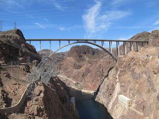
Tillman Memorial Bridge). We walked through the display and up onto the bridge sidewalk (separated from the roadway by a head-high wall) and about halfway across the bridge before returning to the car. There are lots of signs explaining the construction of the bridge - pretty interesting. We drove past the parking garage, across the dam and another pay-parking

lot to the first free lot which still had an empty slot. then it was only a short walk back to the dam through the light, early-morning crowd. The road (old 93 across the top of the dam) is only two lanes and it was clear how it must have been a real bottleneck before the new bridge was completed (Oct 2010). There were many photo subjects - the water inlets, the Winged Figures of the Republic and High Scaler sculptures, among others. We took the power plant tour ($9 ea, senior price) which included a movie, elevator to the bypass tunnel and another elevator to the generator bay then back to the self-guided exhibits and view from the terrace. It must have been close to noon when we were on our way again, in slow traffic until we hit the new bypass. We stopped for gas and lunch in Kingman, noted now for it's location on old Rte 66. Then we took I-40 to US 93

south through Chino Valley and then 89A up the scenic drive to Mingus. At the summit rest area, we stopped to check the computer for the coordinates of launch, plugged them into the GPS and headed up the gravel road. A passing ranger confirmed that the hang glider launch and campground was up at the end of the road. At the gated CG we met Kris Thomsen and Nicole Charrow and they gave us the tour of the concrete HG ramp and the new, grassy PG ramp and ran into John "Ole" Oleson. Later we set up camp in the excellent ponderosa-shaded Forest Service-style camp with picnic tables, fire rings and concrete pit toilet (about 11 sites but some are double and many more tents could be accommodated between sites). There is no water or electricity but there is a USFS CG just a mile down the road (not as nice, though). After dinner we brought our chairs over to the communal fire and Andy and Linnie (sp) from Flagstaff also joined the group (K & N, Dan and Erin, Bill Comstock, Ole, others). It was windy but people had flown (no PG) and some had gotten as high as 13,200 from the 7800 ft launch. It got cold pretty quickly since sunset on Arizona non-DST is around 1930. By 2130 we were ready to climb into our sleeping bags inside our tent with the fly zipped up. It was quite comfortable.
22 May, Sun - The forecast today was for strong winds and there were no PGers around anyway so we left after a great breakfast of French toast. We stopped in Cottonwood to walk out to the bailout LZ which turned out to be a decent grassy field instead of the sage-and-cactus I feared.

We did not know where the regular LZ, the 10th St LZ, was located so we could not eyeball that. We decided to take advantage of the fact that we could not check in at our condo until after 1630 to tour a couple of national monuments. First we went to Montezuma Castle which had two cliff house complexes of the Sinagua people and we walked an interpretive loop. Then we drove to Montezuma Well which was a lake in what looked like a crater. The Sinagua had tapped the underground exit of the lake (part of the 1.5 mil

gal daily) and built irrigation canals around 1200-1450, then disappeared. We walked up to the rim, down to the lake at the swallet, or outlet, then went back up and down to find the other end of the swallet and the canals. From the Well we took a gravel road back to SR 260 and spotted what appeared to be a cougar crossing the road along the way! SR 260 (along with SR 87) seems to be the main route out of Phoenix to the Mogollon Rim highlands. We bought gas and a pint of ice cream in Payson and started the big climb up the Rim. The Outback's gas mileage really suffered for a while but then improved once we got up on top. We passed through Show Low and

pulled into Pinetop
(photo, left) around 1730. The GPS did not have the street or address for the Worldmark Condo so we had to get out the computer and look up the confirmation email with directions. After checking in we carried all of our gear up to the 2nd floor condo (puff, puff - definitely at 7000 ft). Later I went in to Safeway to get some groceries (and found liquor on sale at a better price than at Costco in LV). We got the internet connection working (but had to call to ask about our password).
23 May, Mon - (I had a case of digestive upset overnight

but was okay in the morning - until another bout while we were out hiking later.) After getting some info about hiking from the resort front desk, we went into Lakeside to the ranger station where we picked up a printout of all the local short hikes for $2.00 and two other pamphlets about hiking near Alpine and near Springerville/Eagar. We did a short 1-mile walk on the Mogollon Rim Overlook trail and then drove past Powell Butte to the Panorama trailhead and hiked up Twin Buttes for a scenic lunch hunkered down out of the wind. Back in town we went to Safeway for groceries and to check with the pharmacy about getting more metformin and the simvastatin that I somehow left home. Back at the condo C.J.finished up the laundry, we downloaded and adjusted photos and took a walk around the property.
24 May, Tues - Up early, we headed east to find Greens

Peak, a local flying site. FS 117 took us to a spur road that wound up the cinder cone to 10, 133 ft. If the wind had not been howling (and the temperature frigid), it would have made a great launch with ample flat fields below (The base is at about 9500'). But we drove back down and went to find a more pedestrian activity.

Escudilla Mountain is a long, high (10,912') ridge with a fire tower on the south end. The trail to the tower is about 3 miles and starts in an old burn now covered with aspens that were just coming into full-leaf. Above that were pine, spruce and meadows. We reached the tower but the wind was so strong and gusty that we climbed only two flights before descending to find a sheltered but sunny spot for lunch. We met only one other hiker on the trail the whole four hours we spent on the mountain. Driving back via Springerville and SR 60, we passed through lava and cinder cones to Show Low where we picked up some propane and groceries at Walmart. In Lakeside/Pinetop I picked up my overpriced prescriptions at Safeway and grabbed some additional groceries and sale-priced liquor. Then back to the condo to rest up from the hike.
25 May, Wed - After once more boiling-over the oatmeal and checking the weather (lt winds incr to W at 15), we drove to Green's Peak again. [On the way we stopped for gas at Hon-Dah Casino

within the White Mountain Apache Reservation.] This time the
velocity was about perfect but the direction was from the N (and launch was only possible from S through W). We waited for a while but finally decided (11:11) that it was not going to improve and went off to find a place to hike. Still it was a worthwhile detour because we spotted a wolf (Mexican Gray) in a meadow on the way in to Greens! We found our way to the trailhead for the west fork of the Black River trail which followed the pine-covered canyon rim for three miles until the last quarter mile where it descended to the stream. We passed no other hikers on the trail but there were a good number of folks free-camped in the woods all around the Big Lake region (once they were outside the "no dispersed camping area"). We tried out our new UV water purifier but the water really wasn't cold enough to make it worthwhile. It was a bit of a slog to climb back up to the canyon rim in the sunshine (and wind-shadow). Back at the condo we took a swim in the outdoor pool (heated to 84 deg, we were told) and soaked in the hot tub. Afterward we had gin and tonic with some snackies, said snackies might be described as the crumbs in the bottom of the chip bag - camping is tough on chips.
26 May, Thu - We had decided to leave "early" so we had packed up as much as possible on the 25th, so we were out around 0800 for the relatively short trip to Flagstaff. Down off the Mogollon Rim and past Show Low we were out of the pine highlands and into Colorado Plateau landforms - the Painted Desert was only 20 miles to the northeast of Holbrook where we turned west on I-40. It was much too early to check in to the Wyndham Flagstaff Resort when we reached the turnoff so we filled up with gas at Safeway and

drove north to Cameron where we turned west to go to Grand Canyon NP. A sign indicated a scenic viewpoint for the Little Colorado River Gorge and we pulled off to check it out. It was on the Navajo Reservation and there was a small charge for parking and a multitude of Indian artisans displaying their work. C.J. found a nice necklace of hematite and goldstone with a bear fetish that I was glad to buy since her birthday was in just a few days.

The gorge itself was spectacular - not as deep or wide as the Grand Canyon but very steep-sided
(photo, left). We continued to climb and soon entered GCNP; our first stop was at Desert View, the highest elevation on the South Rim at 7500'. We climbed the steps to the top of the tower and had great views of the canyon. We also stopped at Tusayan Ruins, Navajo Point, Moran Point and Grand View before arriving at the big tourist area around Grand Canyon Village.
We went to the Geology Museum

at Yavapai Point and took in a presentation by a ranger; we also stopped at the post office, and browsed the big general store. Then we drove over to the new, and cavernous, visitor center. The plaza outside was actually more interesting especially the rocks with silhouettes of birds, fossils, and tracks. Even though we had planned to do a hike from Hermit Point, we were too tired - maybe due to the wind(?) - and so headed south toward Williams. The more direct route along 180 was also marked as a scenic road, so we took that and climbed from about 6000' back into the pines as we crossed a high pass (8054') before descending into Flagstaff. We had no trouble finding our condo and checked in for our two-night stay. We weren't on the second floor at this one; this time it was a tri-level with the living area on the top floor and the main bedroom on the bottom. For two nights we didn't carry everything inside. Weather reports indicated that it was going to stay sunny and windy through the weekend.
27 May, Fri - Feeling hopeful we drove out to Sheba Crater
(photo, left) arriving about 0930. not knowing

anything about the site, we drove past a vehicle parked in what we later found out was the LZ. We continued on and eventually found a dirt road that took us around the cinder cone. About three-quarters of the way around we could see that the vehicle from the LZ was on the road to the top and well above us. It didn't look like the kind of road our Outback would like so we returned to the windsock in the LZ and waited around for a while. The wind was already pretty strong and gusty and the guys at the top did not launch or make any preparations to launch so we finally headed for our fallback plan.

Walnut Canyon National Monument was not far away and there was a good trail that took us down 185 ft to a ledge on the cliff where the pueblos were located. Some were ruins, others somewhat reconstructed, and still others were just stabilized; all were under a large overhang protecting them from the weather. Unlike at Montezuma Castle, here you could enter the cliff dwellings.

It was a pretty good climb up the stairs back from the Island Trail to the visitor center but the breeze kept it from being too hot. We also walked out along the Rim Trail before returning to Flagstaff to buy some groceries at Walmart.

Back at the condo we had lunch then I went out to JiffyLube to get an oil change, air filter, too. I also had to replace a low beam headlamp on the left side. At Safeway I bought corn and bread, and filled up the tank before returning to the condo. After dinner we walked over to the Activity Center to buy an ice cream cone, then packed up for tomorrow's departure. High winds were still being forecast for the weekend but the plan is to go to Mingus anyway since there will be a place to camp at least.
28 May, Sat - We checked out of Wyndham early enough that we got to the Lowell Observatory

before it opened at 0900 so we wandered around the grounds until opening. Then we looked at displays and watched some videos until a tour at 1000. The highlight was going into the oldest observatory dome (which was originally made of wood and covered with canvas, and not a dome at all). The antique telescope inside was a 24" refractor all built out of brass and steel. It was pretty amazing; but it was not the telescope that Clyde Tombaugh used in 1930 to discover planet X, later named Pluto. We skipped the next tour which would have taken us to that telescope and headed south down Oak Cr Canyon stopping at the popular tourist overlook and again along the creek where we walked in a ways to a creekside lunch spot. Next stop was in tony Sedona where we browsed a Bell's outlet for UV-resistant shirts. They had some but the Goodwill store just two doors down had regular long-sleeve shirts for a quarter of the price. Then we stopped at a visitor info place (to use the rest room) but it turned out to be a scam to direct people to a timeshare presentation down the road at Verde Ridge. Since we were in no hurry to get to Mingus, and the "gift" was $100, we went along for the spiel. We ended up three hours later with the same every-other-year deal that we had with Pahio (now taken over by Wyndham) but at a much reduced annual maintenance fee. After the usual haggling and bribes we agreed to pay $6400 (started at $24,000 for 43,000 pts) for 27,000 pts EOY and they bought our Pahio week for $8500, plus we got a 7-day cruise and some other goodies...and our $100 gift. It was a little late by the time we got to the Mingus AHGA campground and it was filled with pilots and family, but Kris and Nicole made room at their site. It was still cold and windy and we cooked behind a stack of firewood and ate our mac, cheese and sausage in the car. We went to bed early and did not need the down comforter - the wind must have kept the air stirred up.
29 May, Sun - It was a bit warmer in the morning (in the 50's) but still windy. We left for a hike

at 1030, driving the half mile to the day use area and parking there, picking up a map from the FS volunteers at the campground and then descending 1000 ft along the face of Mingus to pass beneath the launch. We stopped for lunch then climbed up the point north of launch returning to camp about 1400. Most folks had packed up and left so, after retrieving the car, we moved into a vacant parking slot next to our tent and hung out in the tent reading until dinner time.

We had some more of the good corn on the cob from Safeway and leftover mac and cheese cooked in the rock shelter that is destined to camouflage a dumpster in the future.
I called Grand Staircase Escalante info center at Cannonville to see if the Cottonwood Road is passable for the Outback and got a "thumbs up" if there's no rain before we get there. There are still no paraglider pilots at Mingus but we talked with some HG and they are looking for a good day Monday with light winds.
30 May, Mon - The wind died overnight and we got up late enough (after 0800) that it was reasonably warm (with a couple layers of fleece, anyway). By 0900 we were thinking about getting our gear ready as the forecast was light west. By 0930 there were cycles up the front and by 1000 we were gearing up. The HG were setting up but there were no other PG. C.J. launched around 1030 and went right up eventually reaching 11,600 ft from the 7815' launch. Conditions got stronger and I had to wait until almost 1100 before I found a lighter cycle that wasn't making the trees whistle. I went left sinking but found lift before reaching the point. Soon I had climbed 2000' above the launch. The conditions were variable with sometime smooth, strong lift (to 1400 fpm) and at other times really ratty, broken, lift-and-sink. After getting over 10,000' I headed east out toward Cottonwood wondering if I could make it around the airport to the 10th St LZ. (At the time I had not realized that I had mistaken a big grassy park farther out for the LZ.) But I ran into BIG sink and became concerned that I wouldn't even make it to the bailout LZ. Just as I finally reached the bump above the bailout, I ran into BIG lift (I noted 620 fpm on the averager.) I climbed above C.J. for a time to launch level but she took off for the 10th St LZ while I hit more turbulent sink and settled for landing in the thermally bailout. I landed softly after a lot of bouncing around and then my wing blew back into some thorny brush. After extricating my wing and packing up, I walked the mile-and-a-half to the airport lounge where there was water, shade and a rest room. Nicole picked me up on her way to get Kris at the 10th St LZ. Kris, Ole and Bob had landed in the LZ while three other HG went over the back and probably landed at the fairgrounds near Prescott Valley. We put our wings in the back of Kris's pickup but got a ride back to camp with Bob and his wife in his crew cab pickup. At the CG we hurriedly packed up and were done before Kris made it back. We started down the road and met him at Mingus Lake and transferred our wings, then continued down the winding SR 89A through Jerome and Cottonwood. Even though it was the end of the holiday weekend, traffic was not a problem going through Sedona or Oak Cr. Canyon. We stopped for gas at Safeway in Flagstaff again and got some more corn and a tomato for dinner. Sunset Crater NM was the nearest public campground so we decided to stop there (also, it was the last CG for 100 miles to beyond Page). There were lots of open sites in amongst the pines and we tried to pick one with enough pine needles to cover the cinders. The temperature was comfortably in the 60's even though we were once again at an elevation of around 7000 ft, and there was no wind. [Two busloads of firefighters arrived around dark and set up a whole forest of dome tents. They left early the next day for what we assume was some training in the Monument. I wonder if they got sent to join the 2500 firefighters on the Wallow fire back near Springerville, AZ, near Pinetop.]
31 May, Tues - C.J. found ice in the bottom of a mostly-empty water bottle this morning

although it had not felt very cold overnight (especially with the down comforter over our bags). I got an overdue camp hairwash in the warm sun before we left. We drove the Sunset Crater/Wupatki Nat Mon loop back to US 89 and stopped to climb to the top of a ruin known as The Citadel
(photo, left).

Back on the highway we headed north past Cameron and along the Echo Cliffs. We climbed over a pass beyond the jct with 89A (route to Marble Cyn and North Rim) after a brief stop at a scenic pullout overlooking the Kaibab Plateau and the Colorado River canyon.
(photo, left, artisan's tables) In Page we bought some groceries at Walmart and then crossed the Colorado on a bridge above the Glen Canyon Dam (much like the bridge above Hoover Dam but without the high, solid railings.

At Big Water we stopped at a BLM visitor center for Lake Powell and GSENM to check on conditions on the Cottonwood Road. Everything seemed okay so we left the pavement and drove north on the decent gravel road. We stopped part way through The Cockscombs to walk to the low side, and again for lunch under a tree - it was kind of buggy.

Our last non-photo stop was at The Narrows where we parked at the north end and explored the slot canyon to the north and then hiked down the canyon for 1.5 mi. We turned around and retraced our steps, even though the lower part was through pretty deep sand, rather than walk the hot, dusty road back to the car.

By then it was fairly late and we were hoping to find a campsite in Kodachrome State Park, but we stopped anyway at Grosvenor Arch, a spectacular double arch. After driving the mile to the trailhead, we walked the short, paved path to a good viewpoint. The last bit of the Cottonwood Road was the worst part with steep gravelly climbs and even a wet (but shallow) ford. We reached paved road at the entrance to Kodachrome but found a "campground full" sign. The fallback plan was to continue on to Cannonville and go up to Bryce Canyon NP to camp rather than pay three times as much to stay at a KOA. The no-reservation Sunset Campground was filled (except for the A-loop, designated for RVs) so the camp hosts sent us up to North CG where we stopped at the first unoccupied site. It was right on the side of the road but had a decent place for the tent and, anyway, we wanted to cook dinner before dark. We drank one of the little bottles of champagne from our new timeshare in honor of C.J.'s birthday and had spaghetti with sausage, green peppers and parmesan cheese; and an excellent salad.
1 Jun, Wed - Before leaving Bryce, after oatmeal and a shampoo for C.J., we drove around the

CG and said hello to a Canadian who had been out five weeks with his A-frame Chalet trailer. We drove Scenic Route 12 to Escalante and checked with the visitor center about the road to Cathedral Valley in Capitol Reef (no info) and the Burr Trail
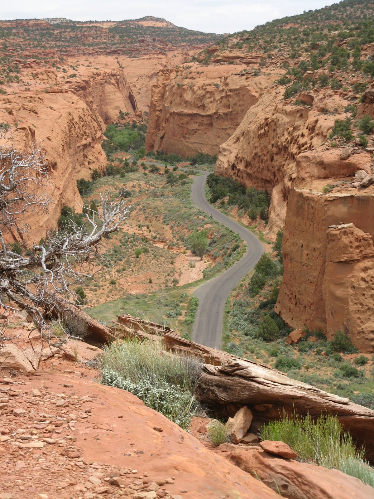
(photo, left) (paved to edge of GSENM) and the Notom-Bullfrog Road (gravel, OK for Outback). So we continued on 12 over the Million dollar Highway between Escalante and Boulder (scenic!) and then down the Burr Trail (Very scenic! Red, sculpted canyons and cliffs)
(photo, right).

We stopped along the way for photos and once for another scenic lunch spot. The pavement ended at a

series of Moki Dugway-style gravel switchbacks descending the Waterpocket Fold, very cool
(photo, left).
Less exciting was the long drive up the Notom Road to SR 24 through desert then ranchland. It was early when we got to Capitol Reef Visitor Center at Fruita (1500) but the ranger told us that the Cathedral Valley road was too rough for our not-high clearance vehicle so we had to go to plan B and camp at Fruita.

We hurried to the CG and got one of the last sites, a little inconvenient because it was situated in the walk-in tenting area, still it had a scenic view.

After setting up we got our hiking stuff and left right from the CG and climbed to Cohab Canyon, a hidden canyon with several side slot canyons.

We went about a mile and a quarter before turning off on a spur trail that took us to a viewpoint out over Fruita, the Fremont Canyon
(photo, right) and SR 24. We were back by 1830 and the bugs were so bad (The hatch had just begun, someone told us) that we didn't cook but had wraps with the last of the guacamole, cheese, ham, lettuce, etc.. Then we hid out in the tent after the wind died down and C.J. had a chance to wash up.
2 Jun, Thu - Up at 0730 before sunshine reached the tent, but later we were able to enjoy our instant oatmeal in the sun at our picnic table. We were packed up and gone before 0900. SR 24 was surprisingly scenic - but would have been even better heading
toward Capitol Reef. After leaving Torrey and Loa behind, we entered the Basin and Range physiographic province and crossed a ridge/plateau at 8300' then drove along a lengthy graben, the Koosharem Valley. We passed some gypsum mines and continued up to Salina and on to the north on SR 28 to I-15 at Nephi below snow-covered Mt Nebo (almost 12,000'). Along the way we noticed that stream and rivers were running high and there were signs of minor flooding. We stopped at Sandy Costco for gas and lunch then drove up through SLC with the ever-present wind but also some ominous clouds to the north. Going over the high ground into Idaho we had a couple of showers and lots of dark clouds. On I-84 it looked stormy ahead but we drove through one front and stopped at Glenns Ferry around 1800 before reaching the next dark band of clouds. The temperature was in the 50s and it was windy even in the relatively sheltered lower campground at Three Island Crossing State Park so we elected to eat in town. The Fudge Factory served an excellent burger with sweet potato fries and broccoli salad, and we sampled a glass of the local winery's River Mist, a sweet rose', and shared a small mint-chocolate brownie. Back at camp by 1930 I had my first shower in many days - one advantage of staying in the usually more-expensive state parks.
3 Jun, - Fri - Heading for home we skipped breakfast and stopped in Caldwell for Costco gas and Starbucks hot chocolate and scones. I don't think we stopped again until time to gas up at Costco in Union Gap where we also got drinks. We were home to sunny, warm weather in time to see that the grass
really needed to be cut and the garden needed some days of work as well. Except for the wind which kept us from doing more than the one flight at Mingus we seem to have picked a good time to visit the northern, high elevation part of the Southwest.


 So we were on hand for the “shotgun start” of
the potluck dinner. Close to 200 people
were seated at tables in a circle at the dance hall with their potluck dish in
front of them. At 1730, the signal was
given for everyone to stand and move to the right to fill our plates (or, in
the case of most veteran potluckers, sectioned trays!). It was a pretty effective method and
eliminated the long time spent standing in line waiting to get to the buffet
table, or waiting for your table to be called.
The evening dance began at 2000 (1930 for pre-rounds) and everyone was
wearing traditional square dance dress.
At 2200, after the dancing, there were root beer floats, followed by
several skits which were offered up as an “after party”, including a team of
seniors pitted against some young dancers who attempted to identify TV clips
from each other’s generation, e.g. “Animaniacs” and “Lone Ranger”.
So we were on hand for the “shotgun start” of
the potluck dinner. Close to 200 people
were seated at tables in a circle at the dance hall with their potluck dish in
front of them. At 1730, the signal was
given for everyone to stand and move to the right to fill our plates (or, in
the case of most veteran potluckers, sectioned trays!). It was a pretty effective method and
eliminated the long time spent standing in line waiting to get to the buffet
table, or waiting for your table to be called.
The evening dance began at 2000 (1930 for pre-rounds) and everyone was
wearing traditional square dance dress.
At 2200, after the dancing, there were root beer floats, followed by
several skits which were offered up as an “after party”, including a team of
seniors pitted against some young dancers who attempted to identify TV clips
from each other’s generation, e.g. “Animaniacs” and “Lone Ranger”.